slideshow
2014 – 2018
a compilation of academic presentations i designed from my time as a geography undergraduate at the university of edinburgh

a compilation of academic presentations i designed from my time as a geography undergraduate at the university of edinburgh
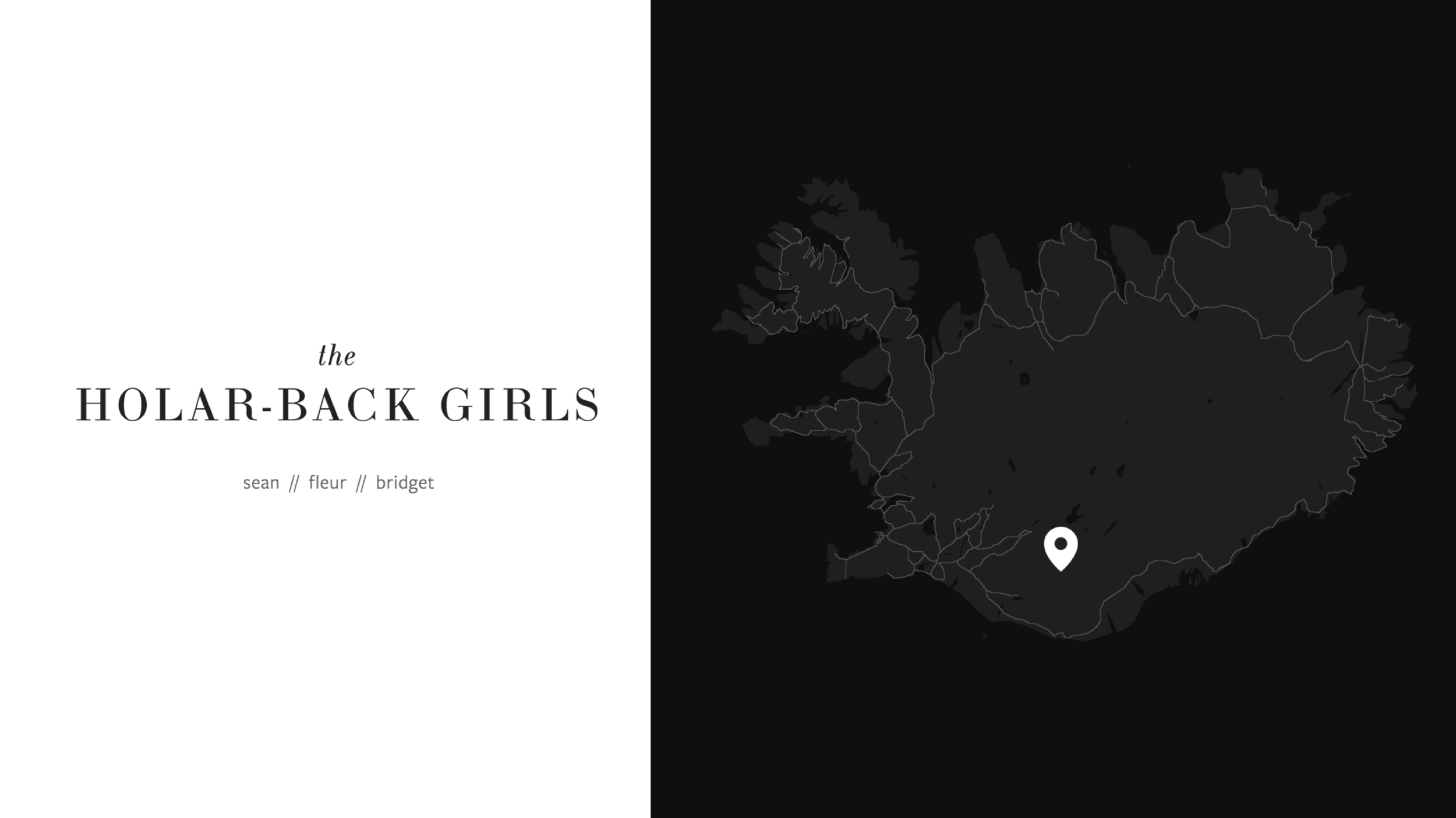
Physical Geography Fieldwork (Iceland) (4th-Year Honours)
The University of Edinburgh
Key Terms:
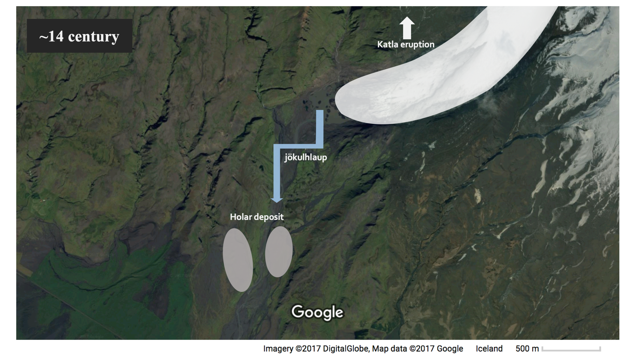
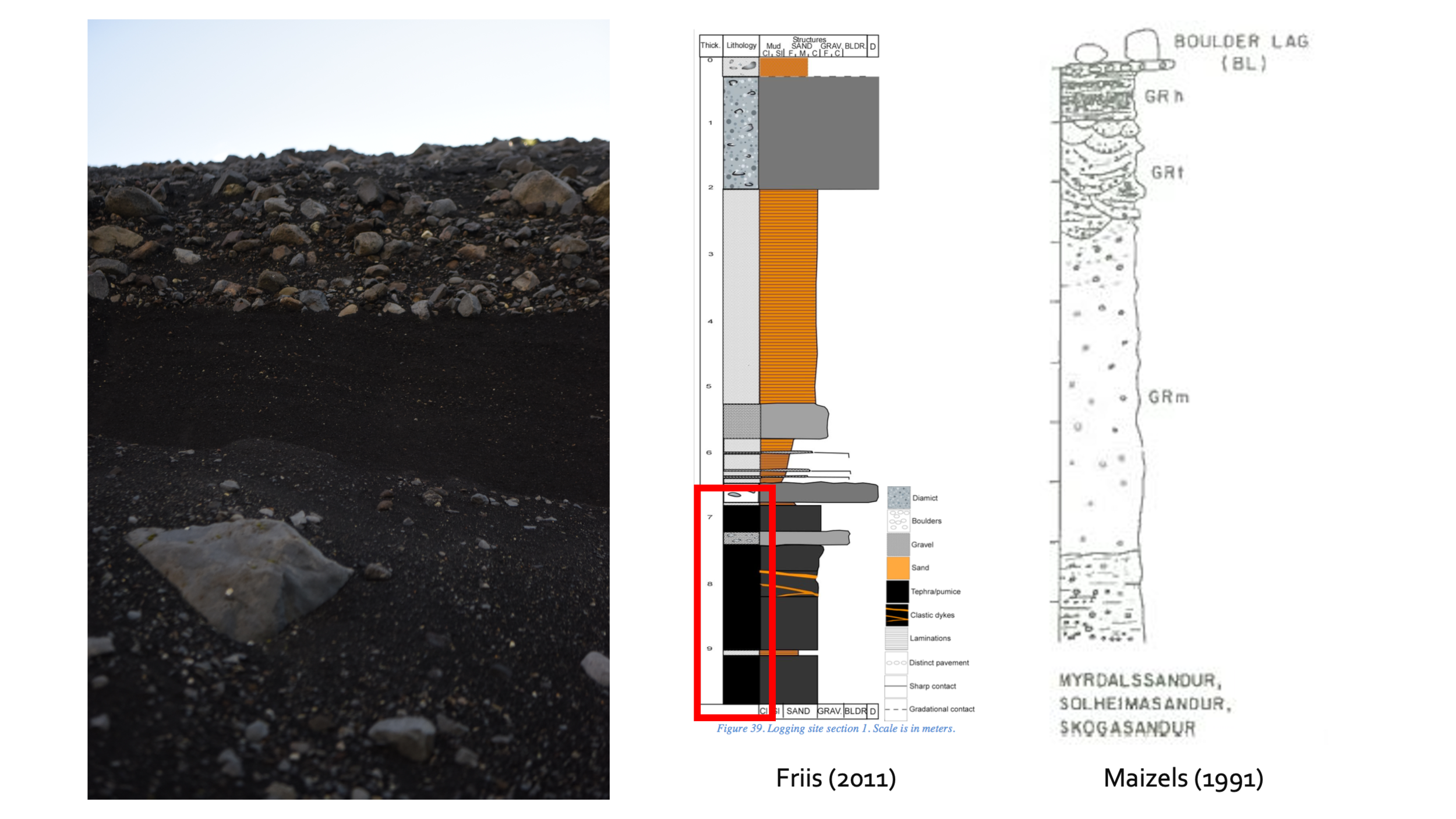
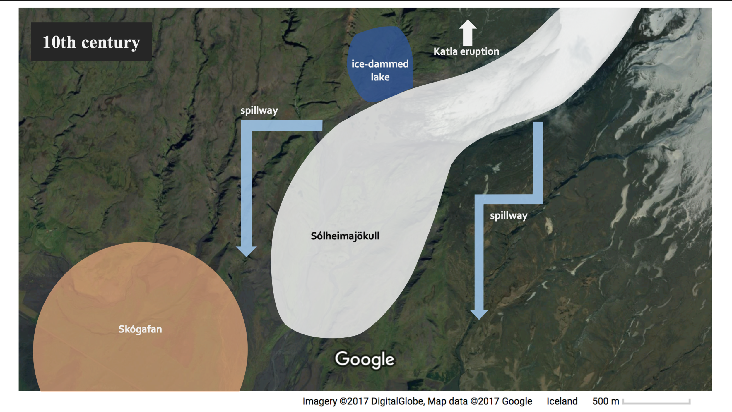
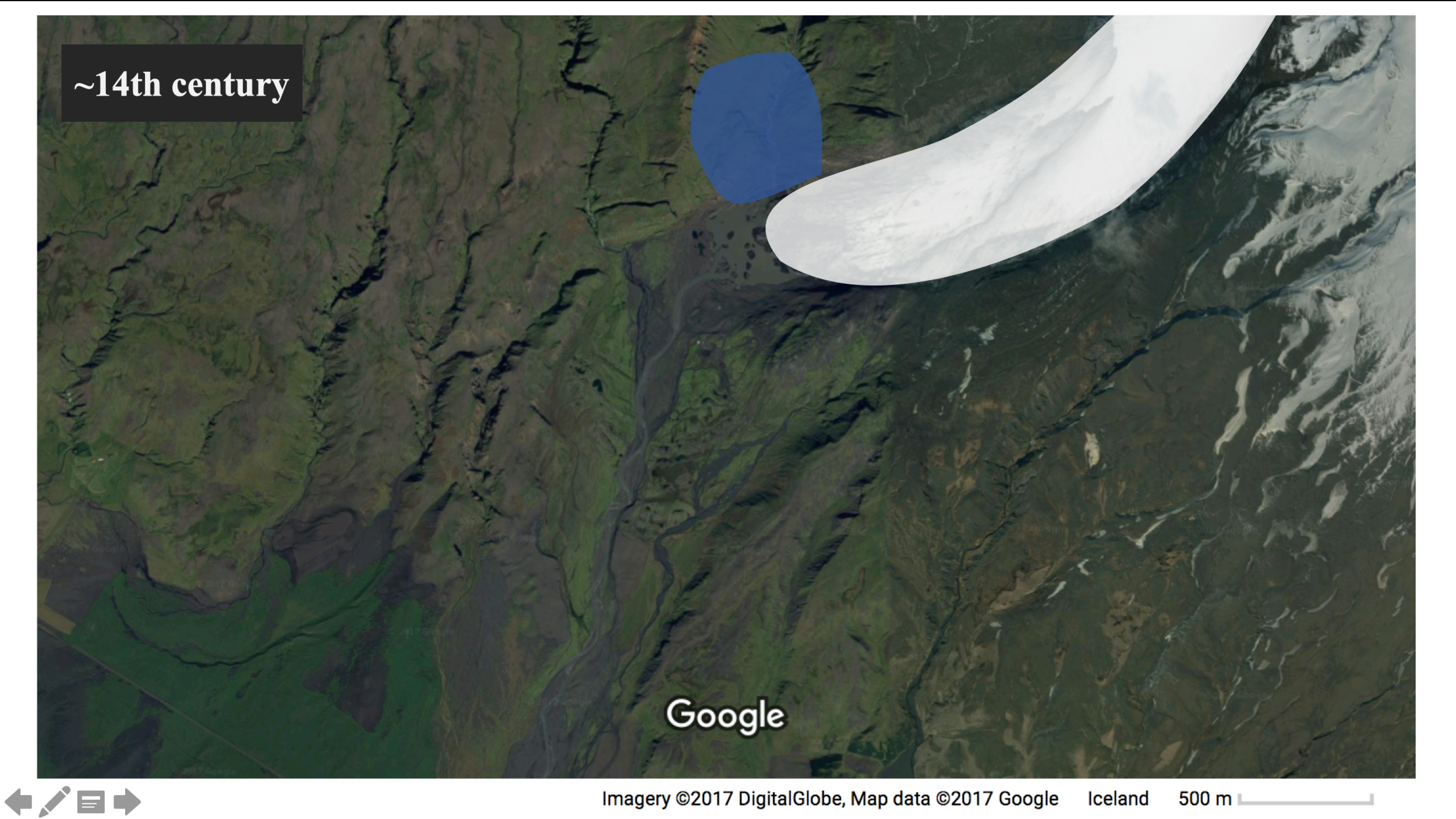
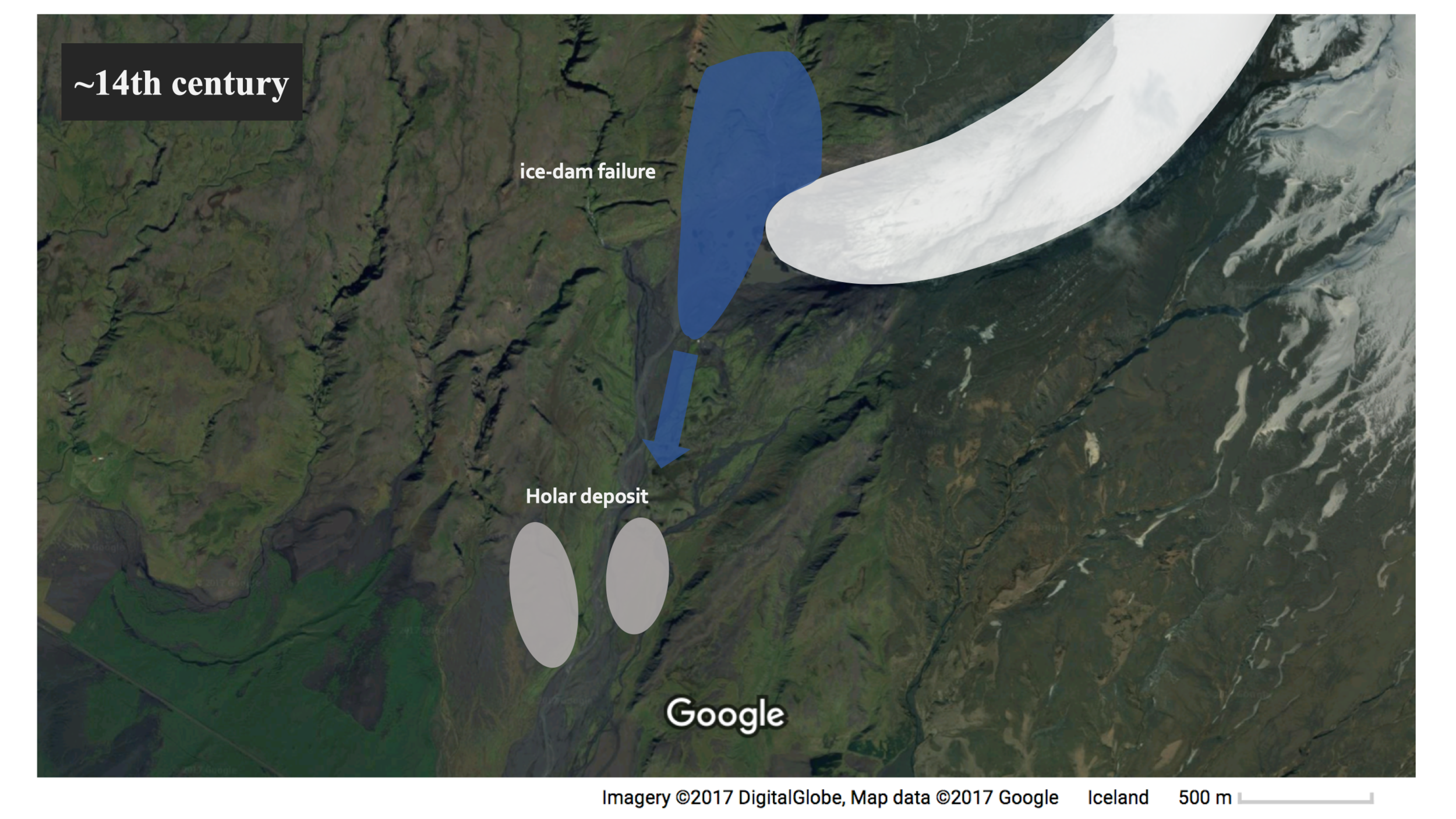
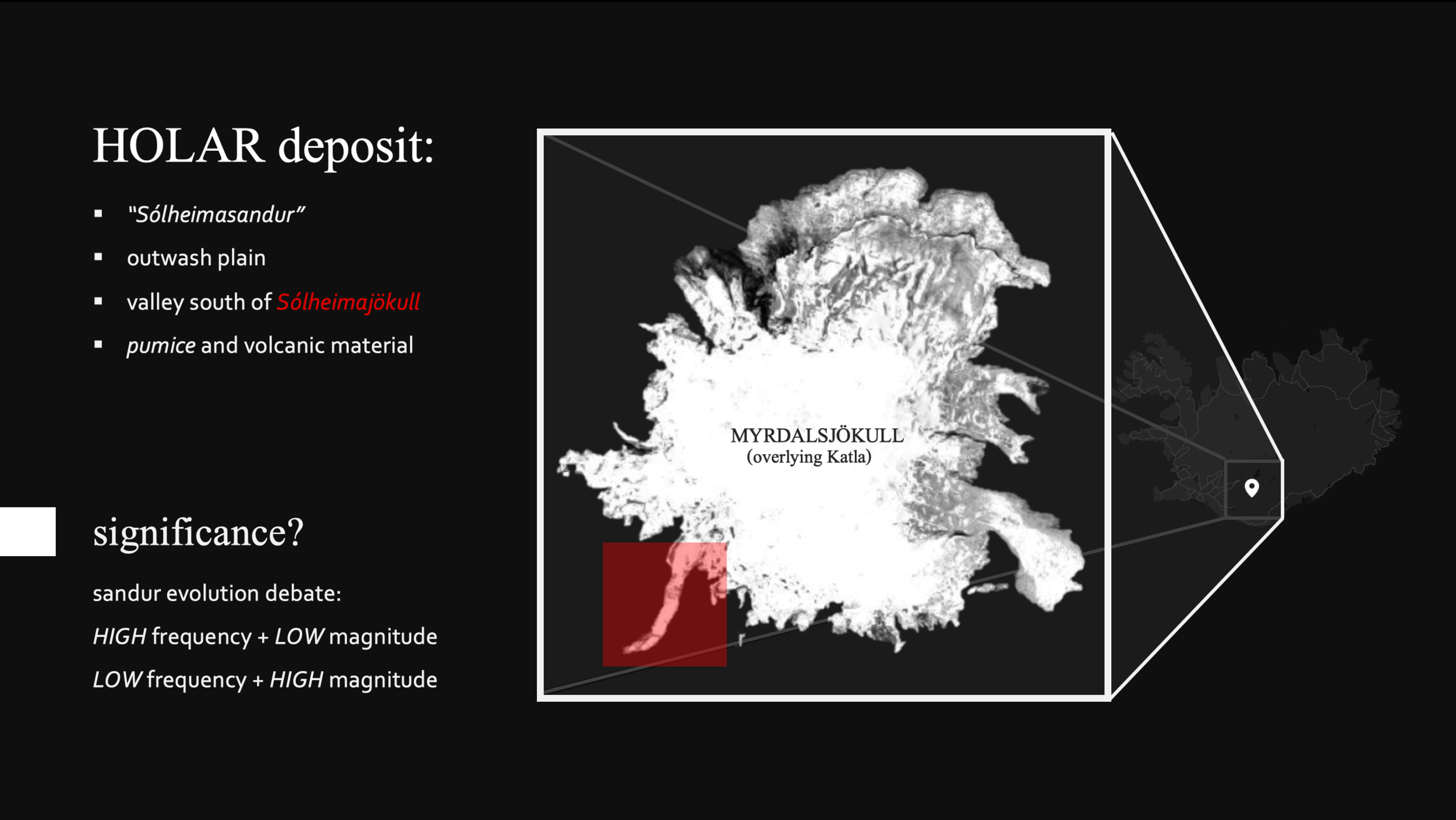
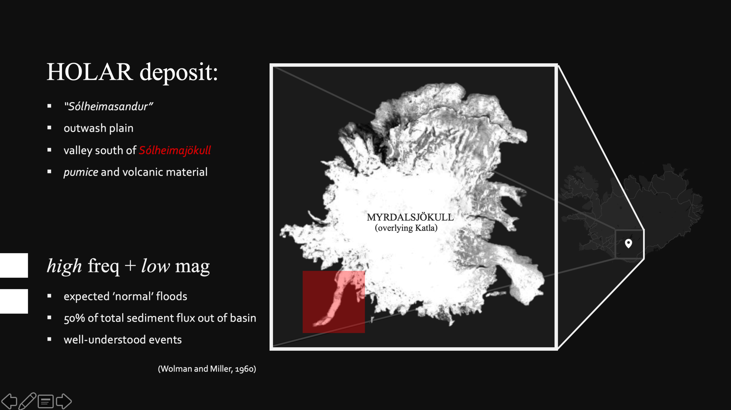
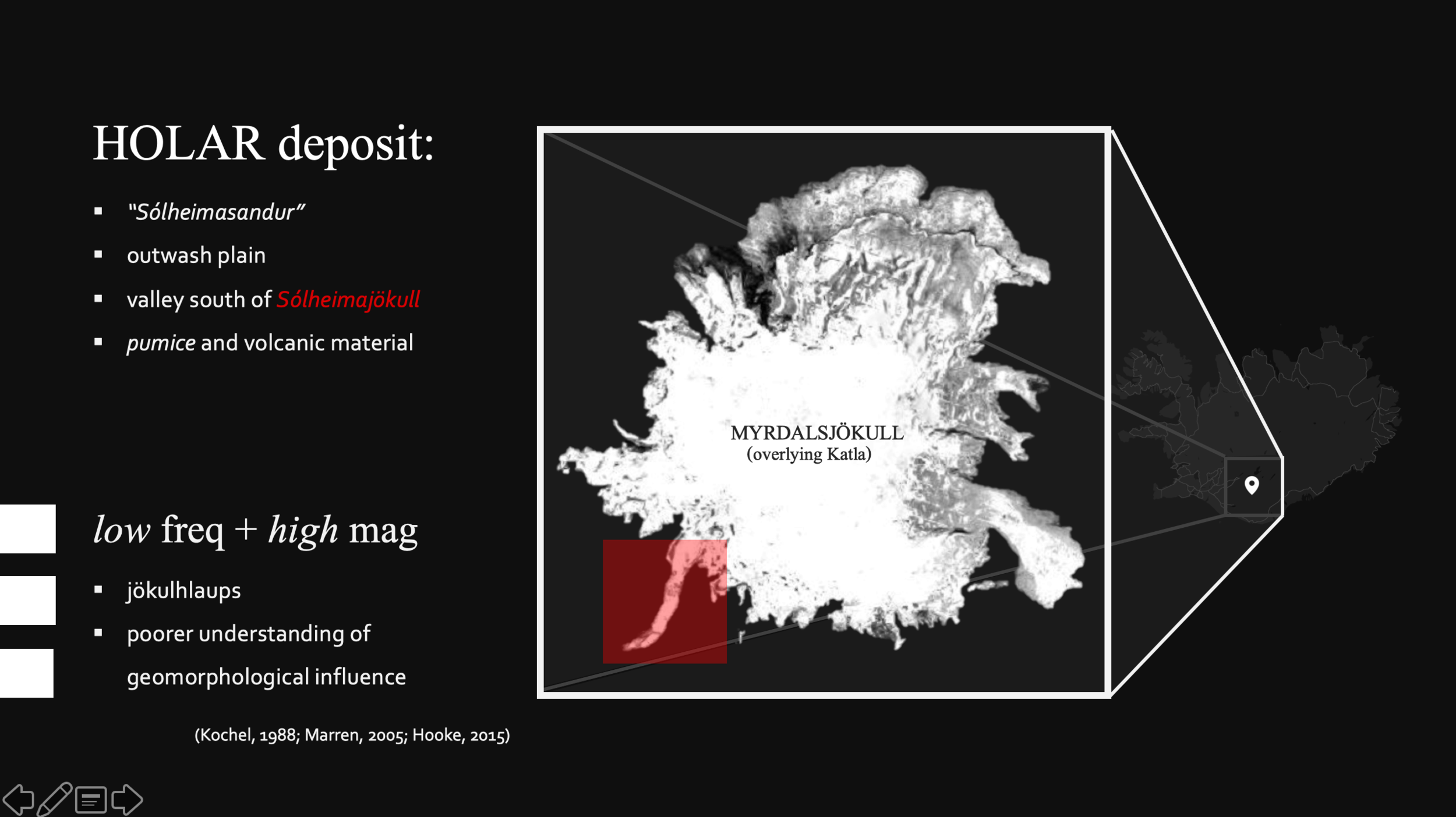
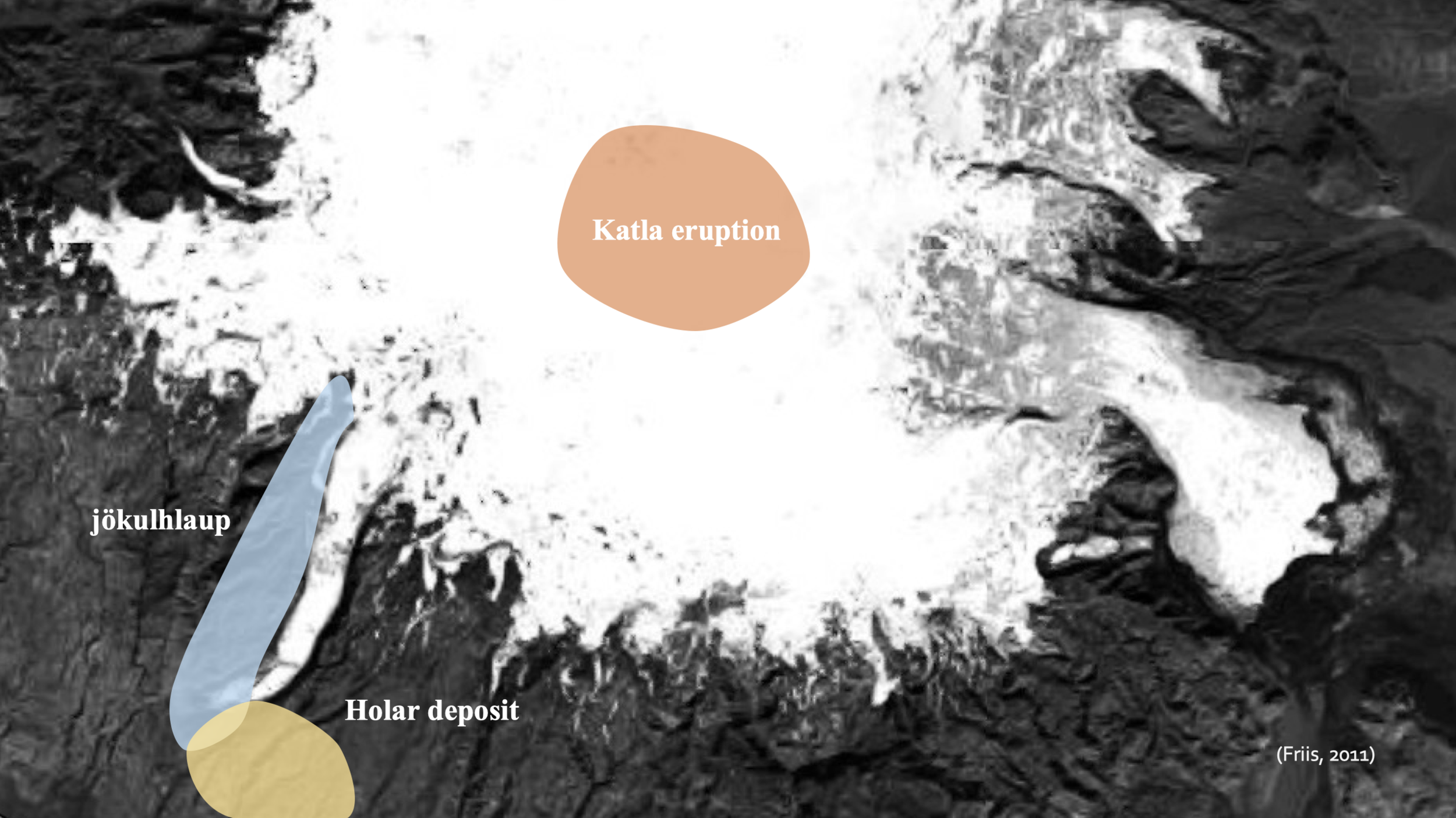
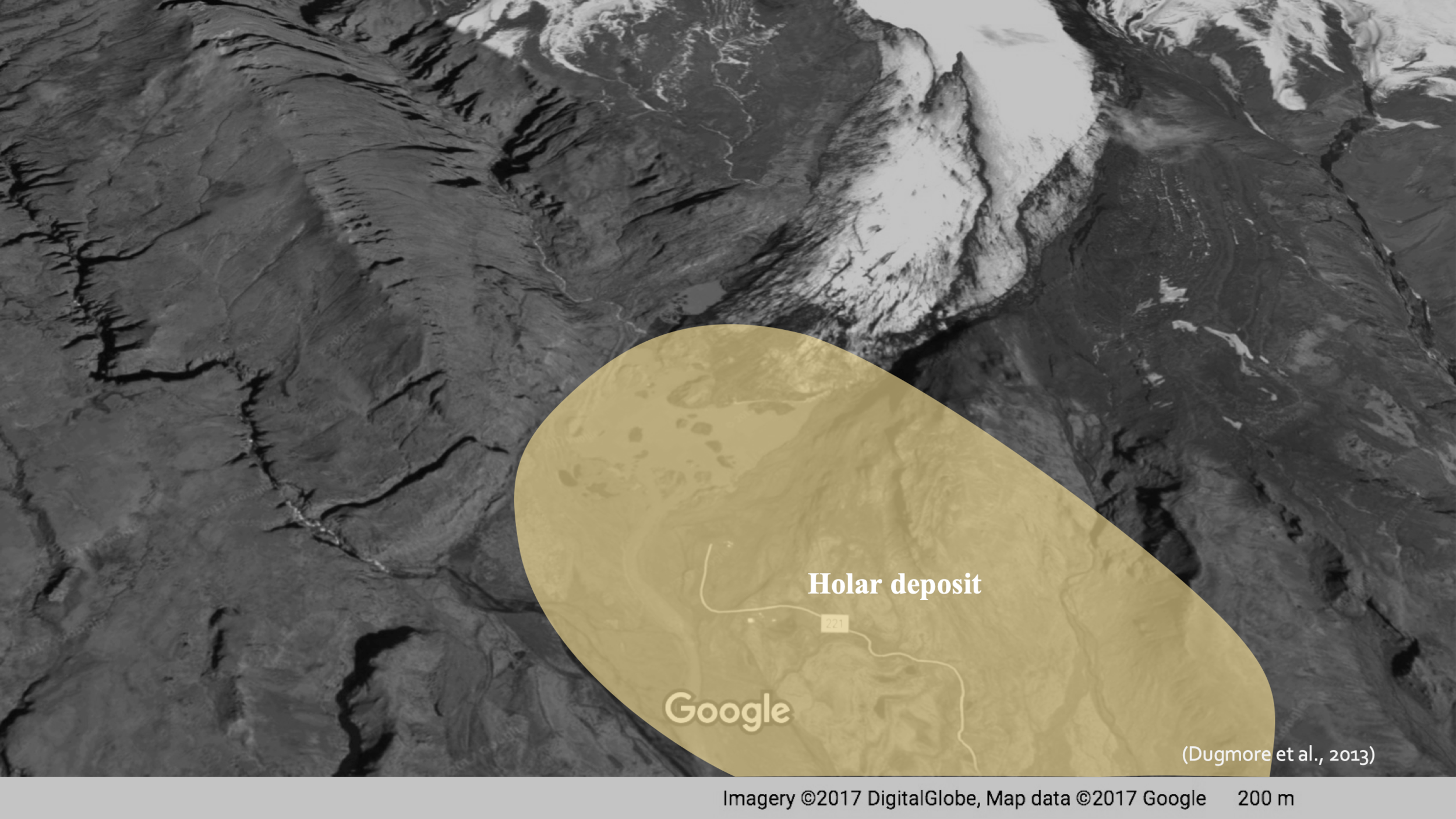
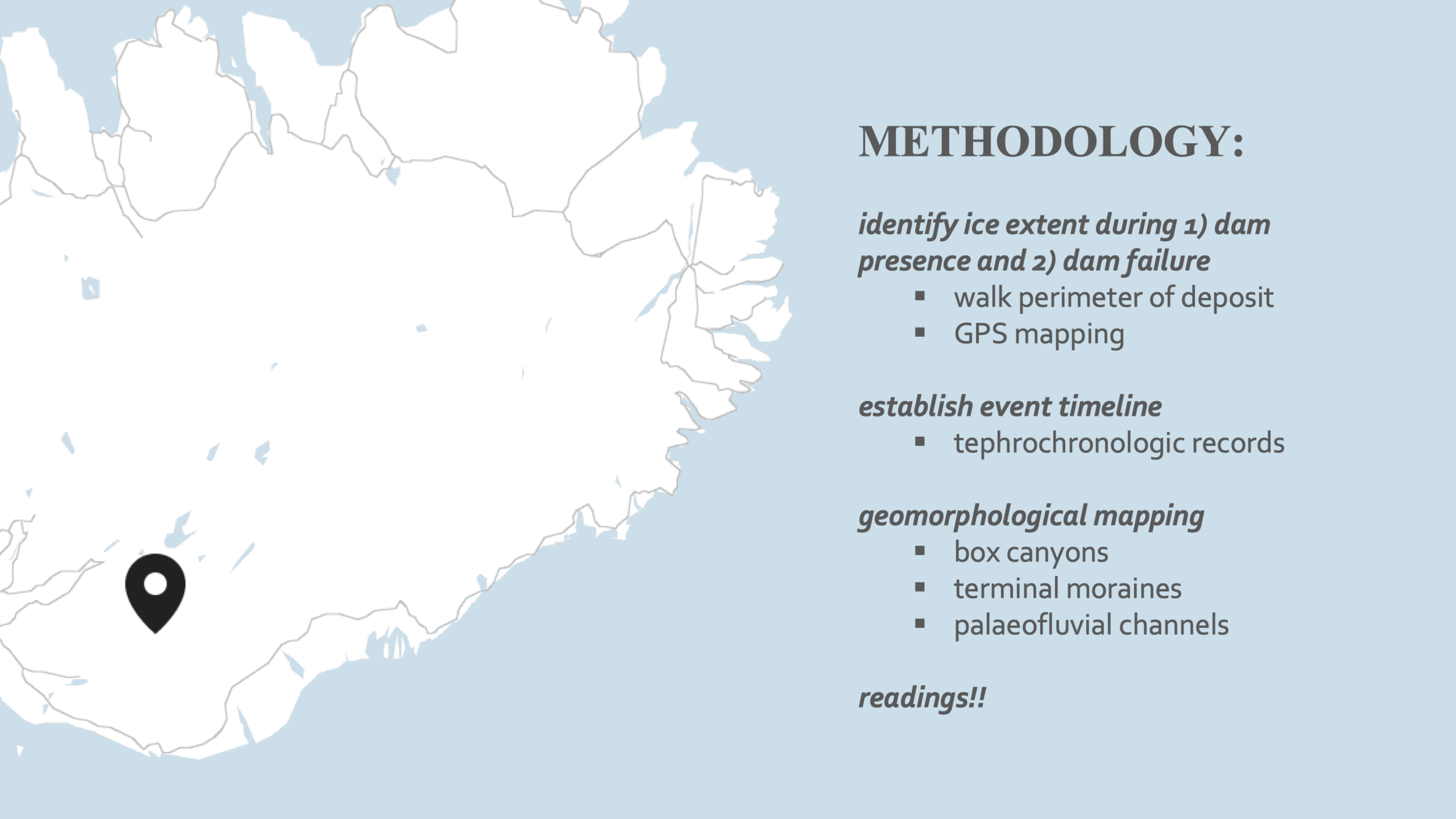
Hólar Deposit – a volcanic deposit situated in Sólheimasandur, southern Iceland
Pumice Gravel – a coarse dark grey material originating from a volcanic eruption
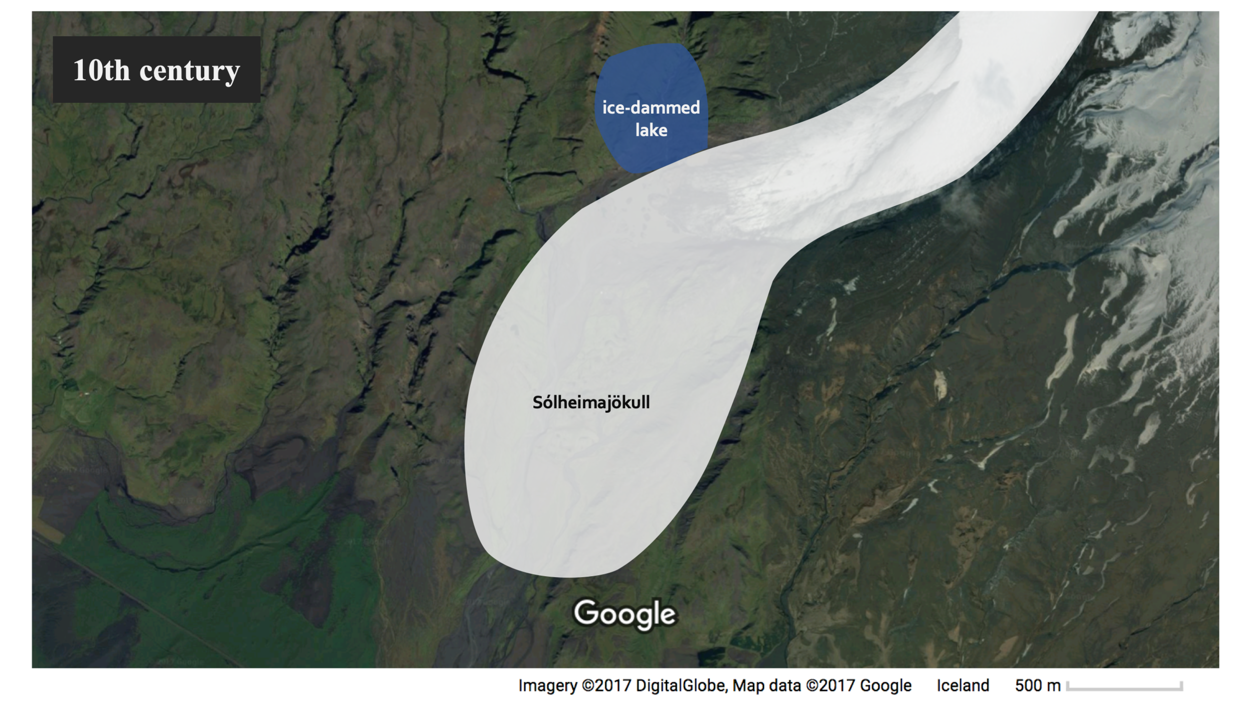
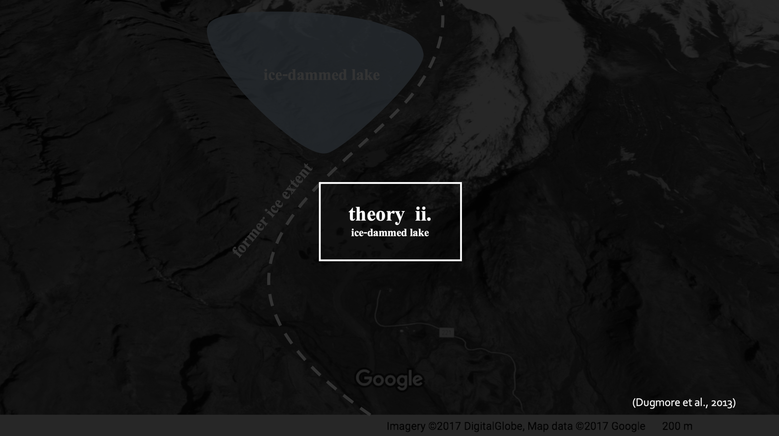
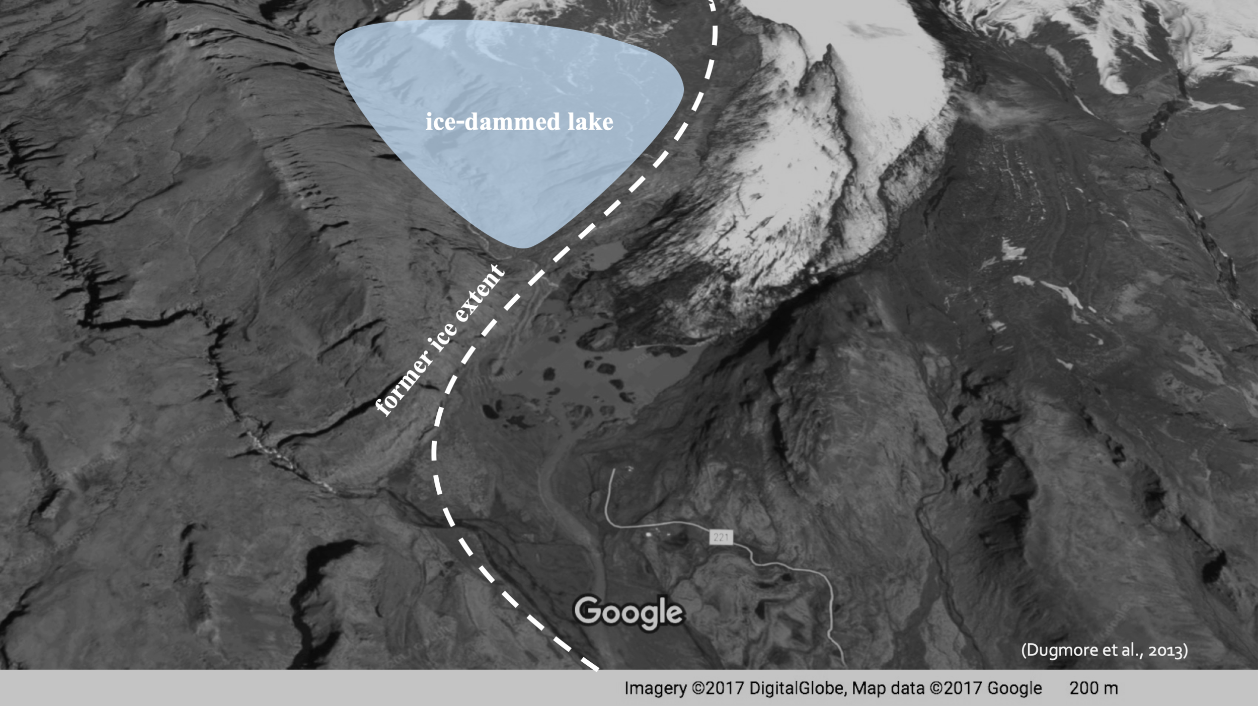
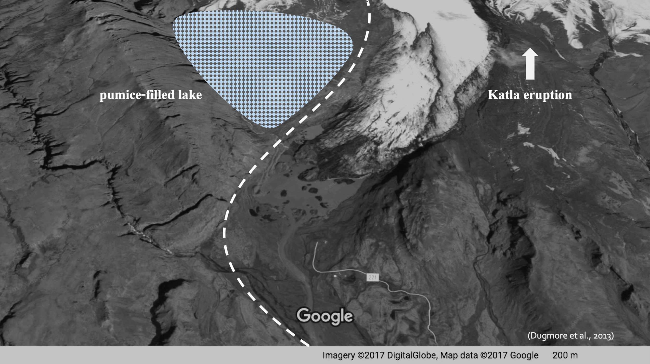
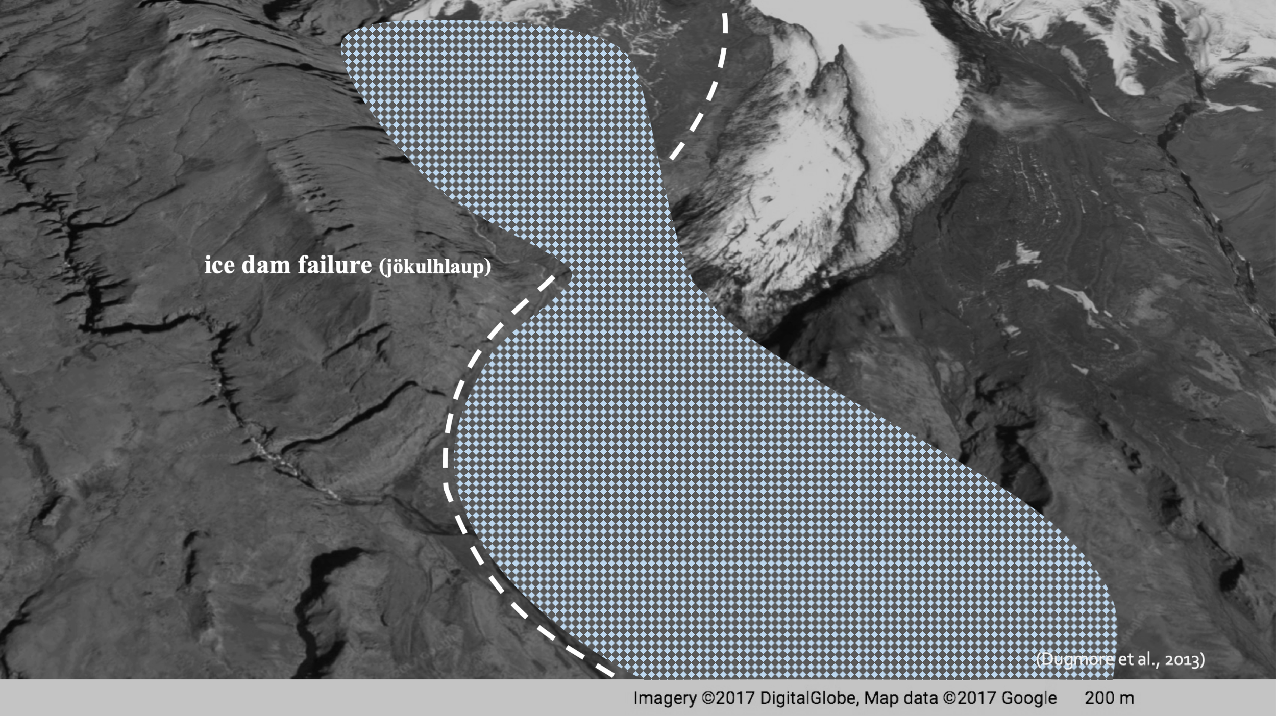
Ice-Dammed Lake – a lake partially bordered by an ice mass (i.e. a glacier) that is prone to drainage upon ice-dam failure or melt
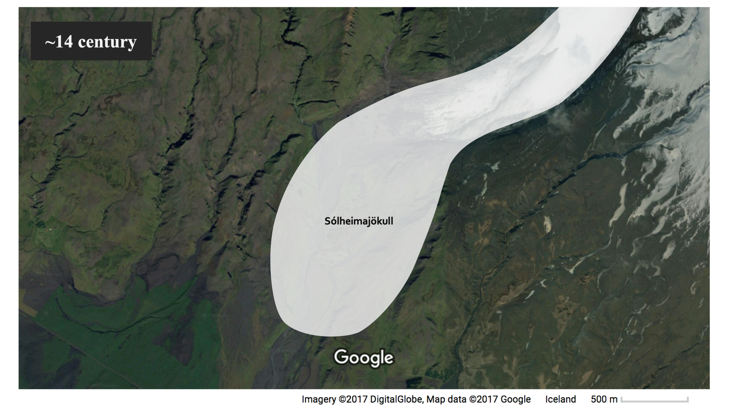
Sólheimajökull – a glacier about 8km-long and 2km-wide that extends south from the Mýrdalsjökull ice-cap, which overlies one of Iceland’s most active volcanoes, Katla
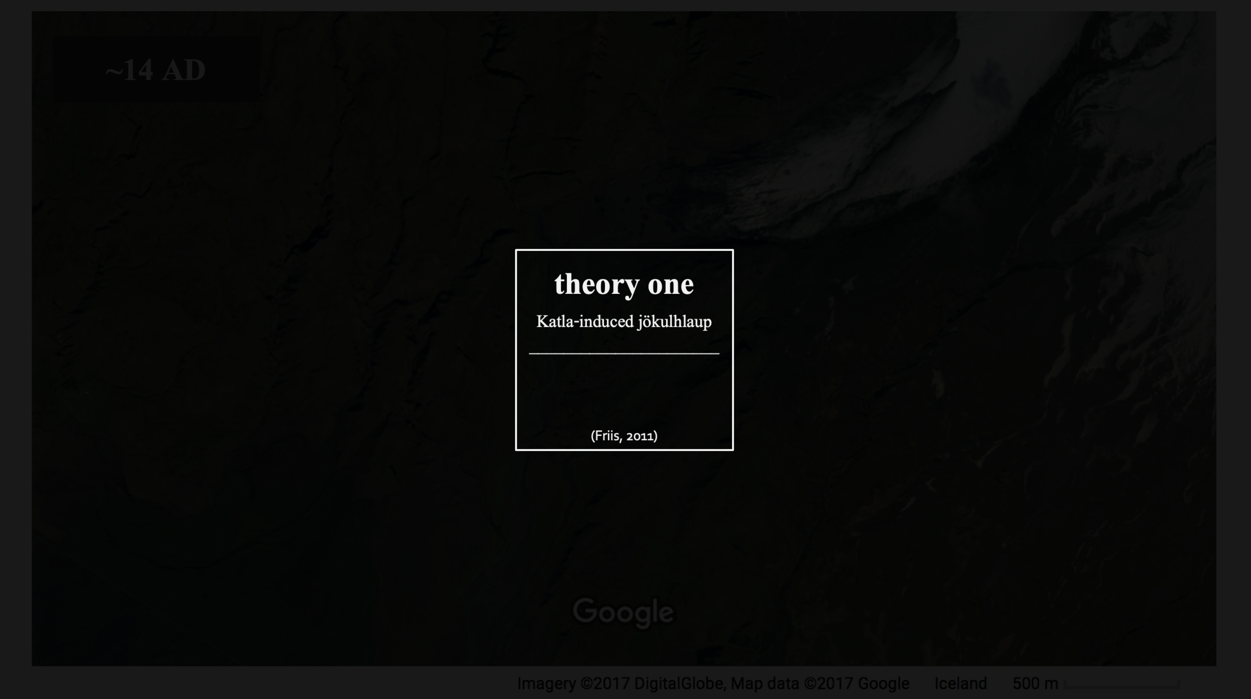
Jökulhlaup – (literally “glacial run”) a kind of “glacial outburst flood”, which in the context of the presented research, was triggered by an eruption of the subglacial Katla volcano that melted overlying ice and produced a major flooding event
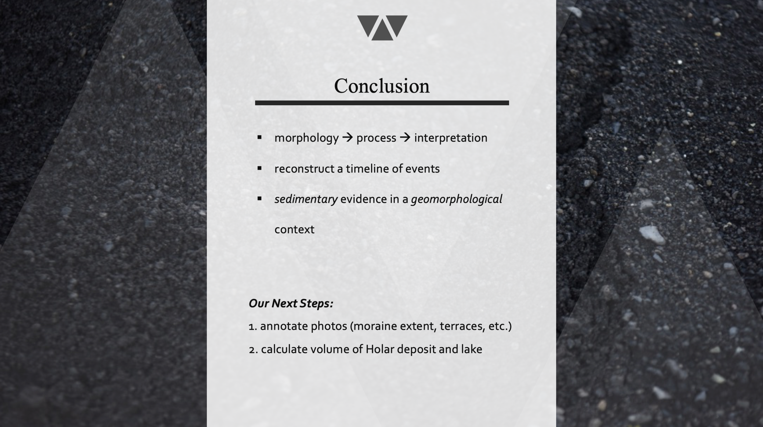
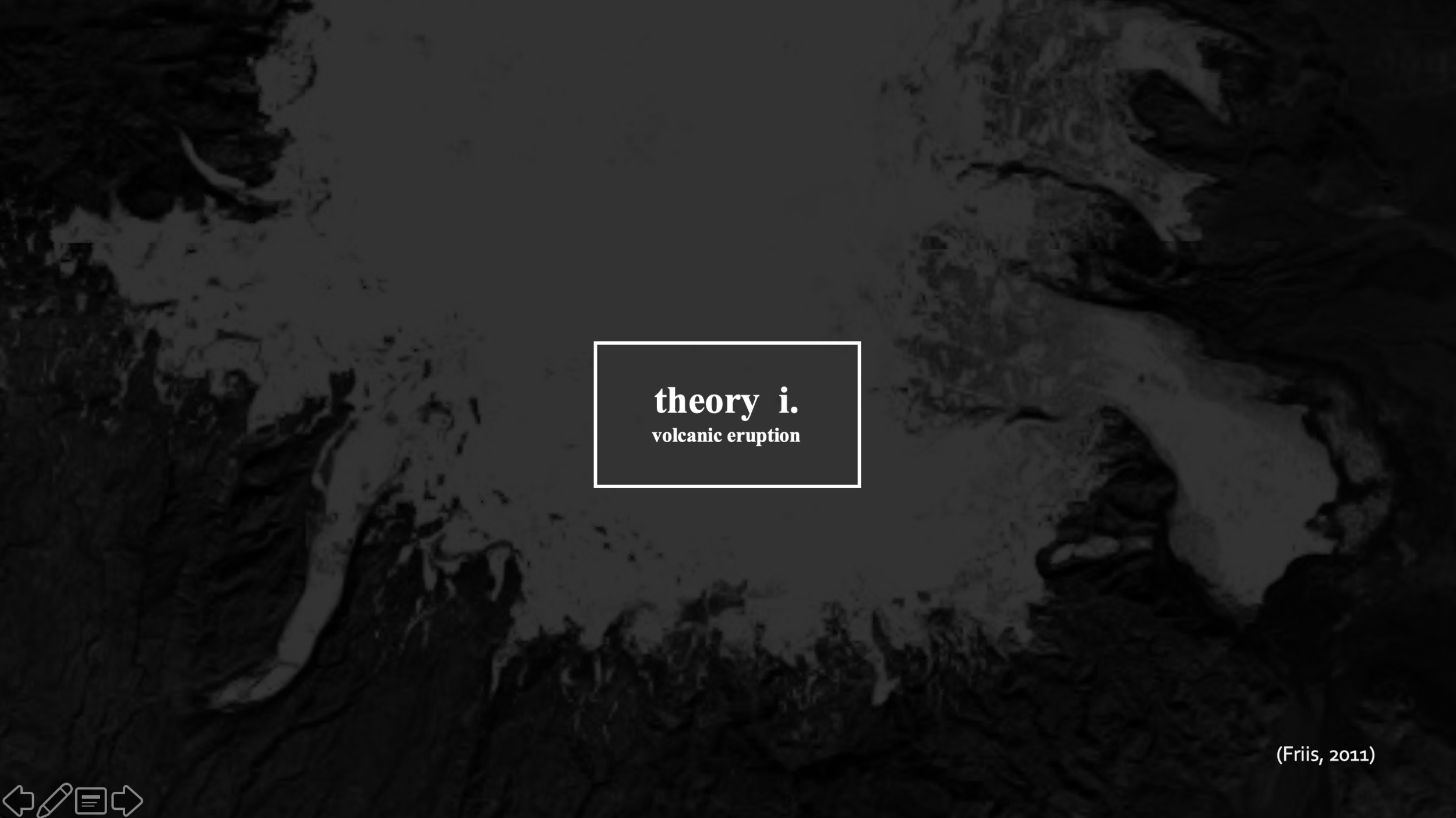
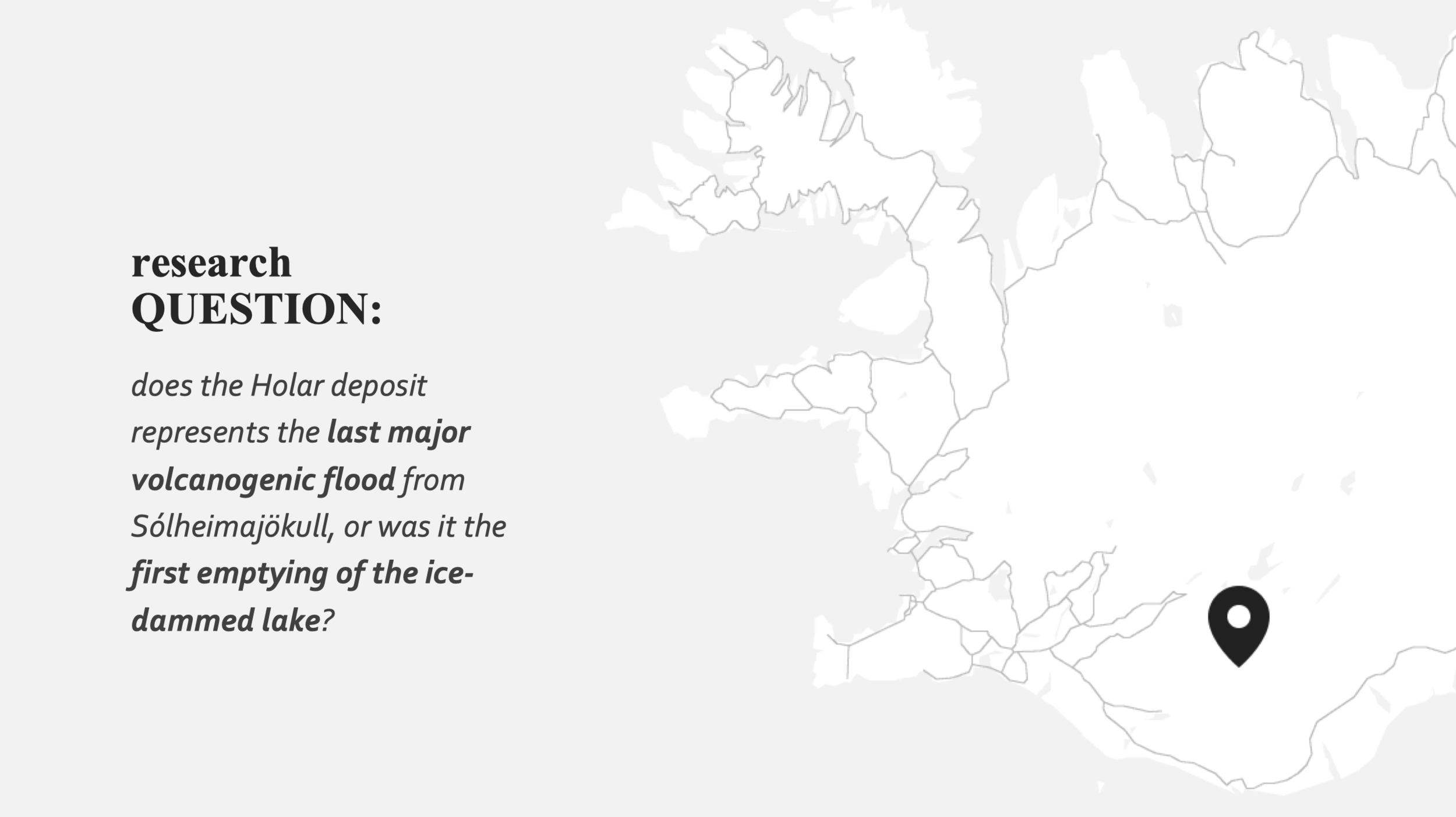
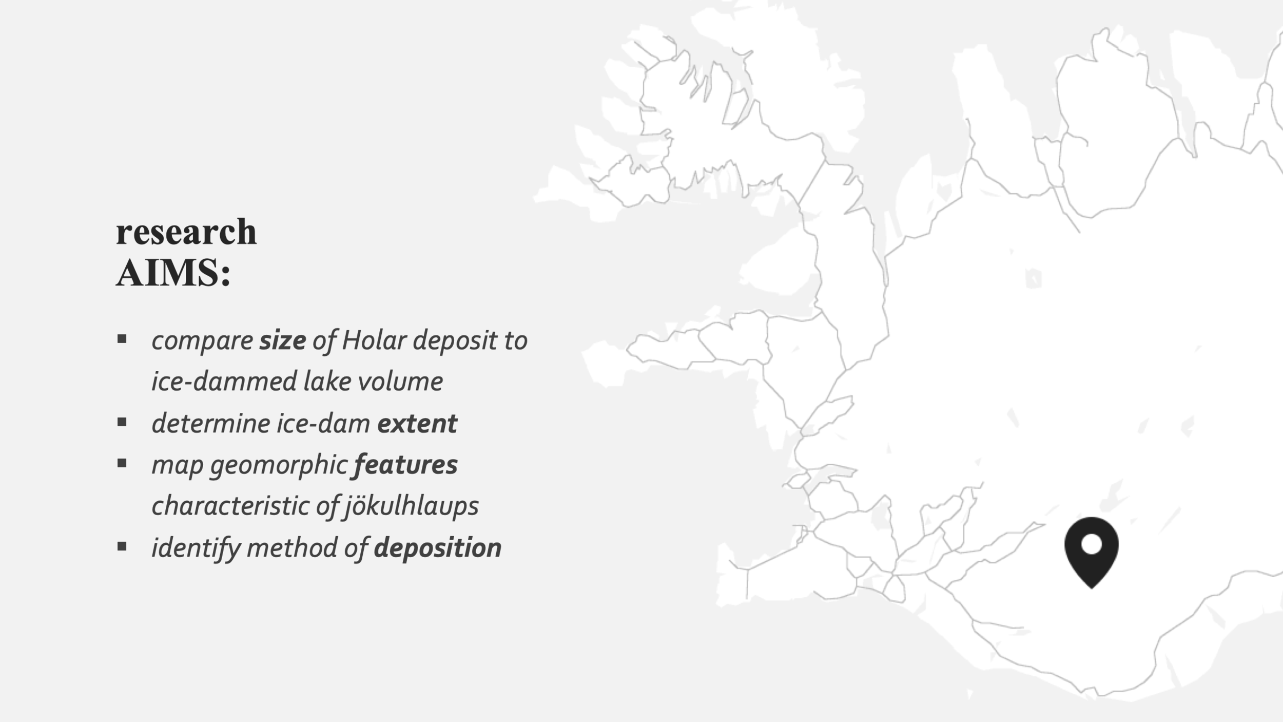
Overview: Spending four days in the field under the supervision of Professor Andrew Dugmore, my group (The Holar Triangle) observed and analysed the geomorphology and sediment profile of southern Iceland’s rather mysterious Hólar Deposit to determine the timing of its deposition. In present-day, the Hólar Deposit forms two distinct mounds bisected by a river in the landscape immediately south of Sólheimajökull glacier. Composed entirely of pumice gravel, the Deposit is material originating from a ~14th-century Katla eruption, though uncertainty remains as to which jökulhlaup event transported it from Katla to its present-day location. There are two key competing theories that address this mystery – one proposed by Professor Andrew Dugmore and the other by Bjarki Friis – and based on our collected data, my group concluded that Dugmore’s theory was the more viable.
Volcanoes, Environment and People (3rd-Year Honours)
The University of Edinburgh
Key Terms:
Pyroclastic Flow – erupted volcanic material consisting of rock fragments
Caldera – a large volcanic crater often formed by the collapse of a volcano after a major eruption
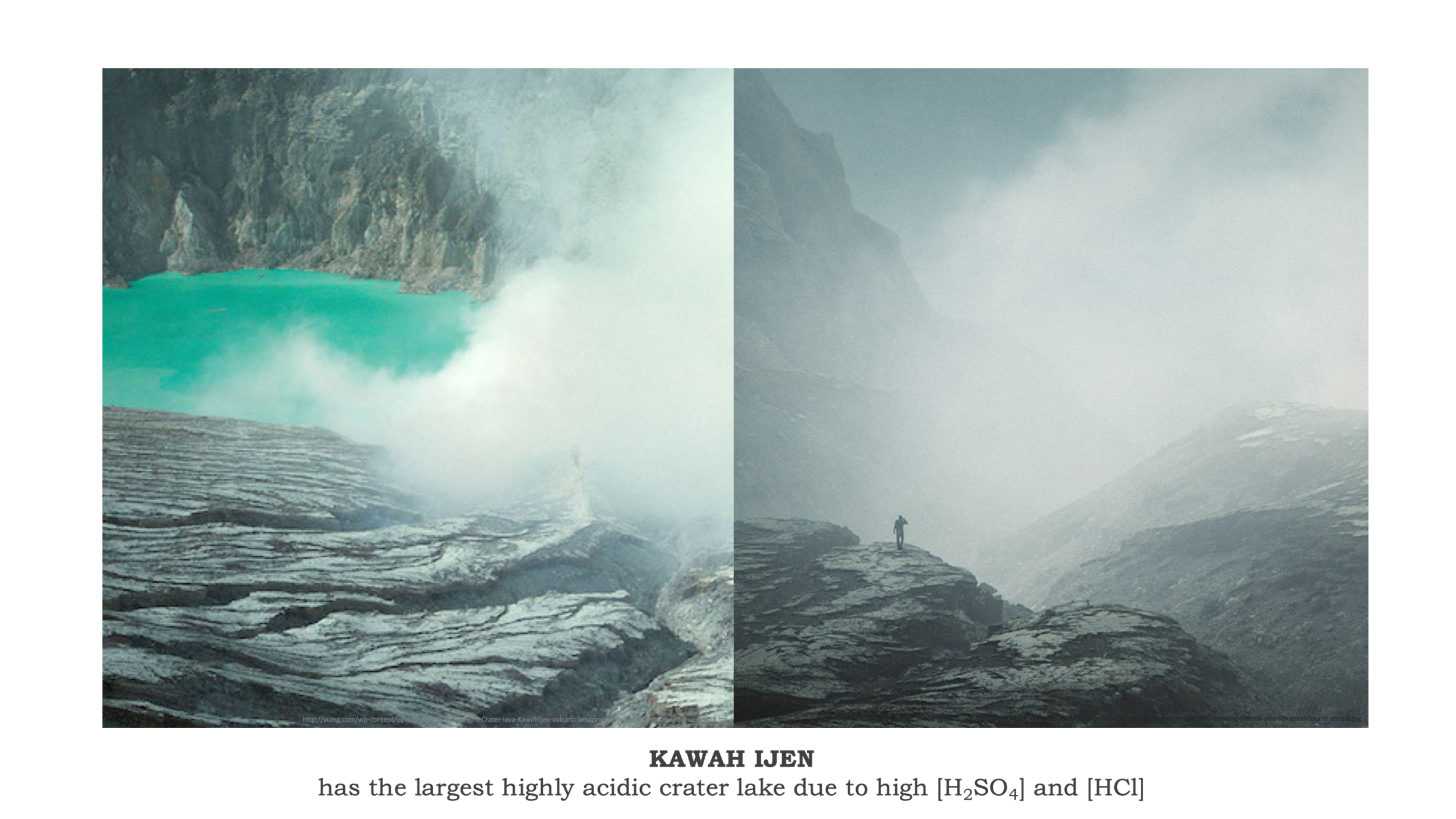
Crater Lake – a volcanic crater filled with water to form a lake
H2SO4 – sulphuric acid
HCl – hydrochloric acid
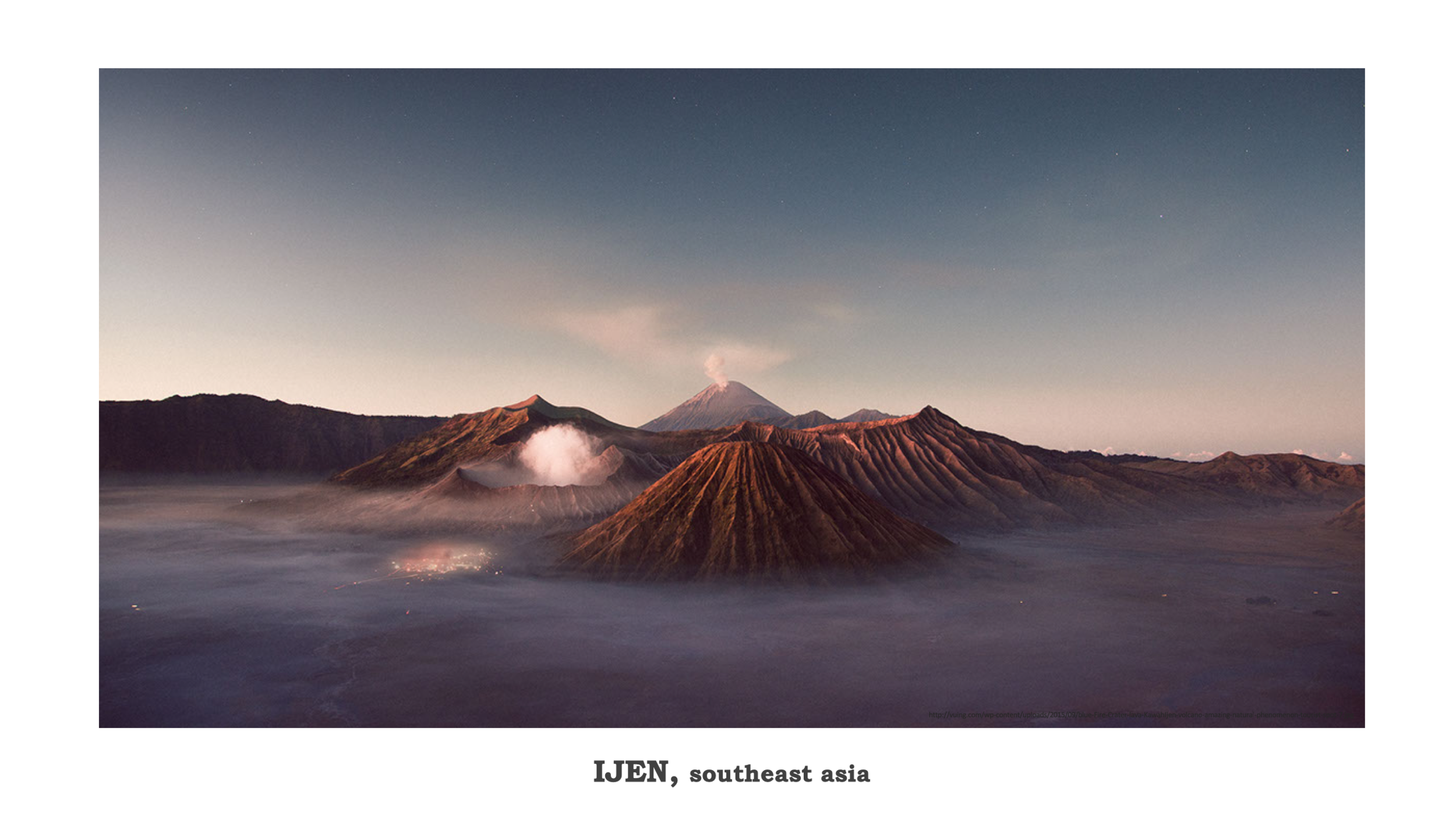
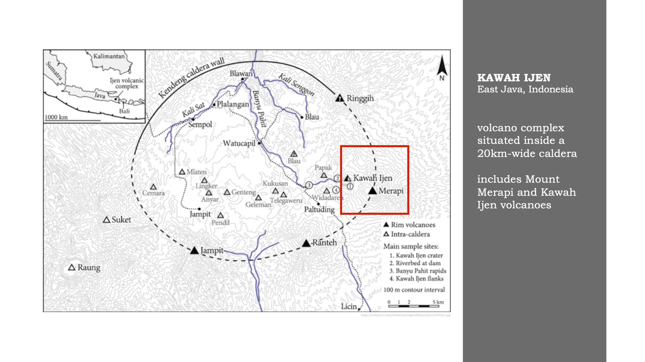
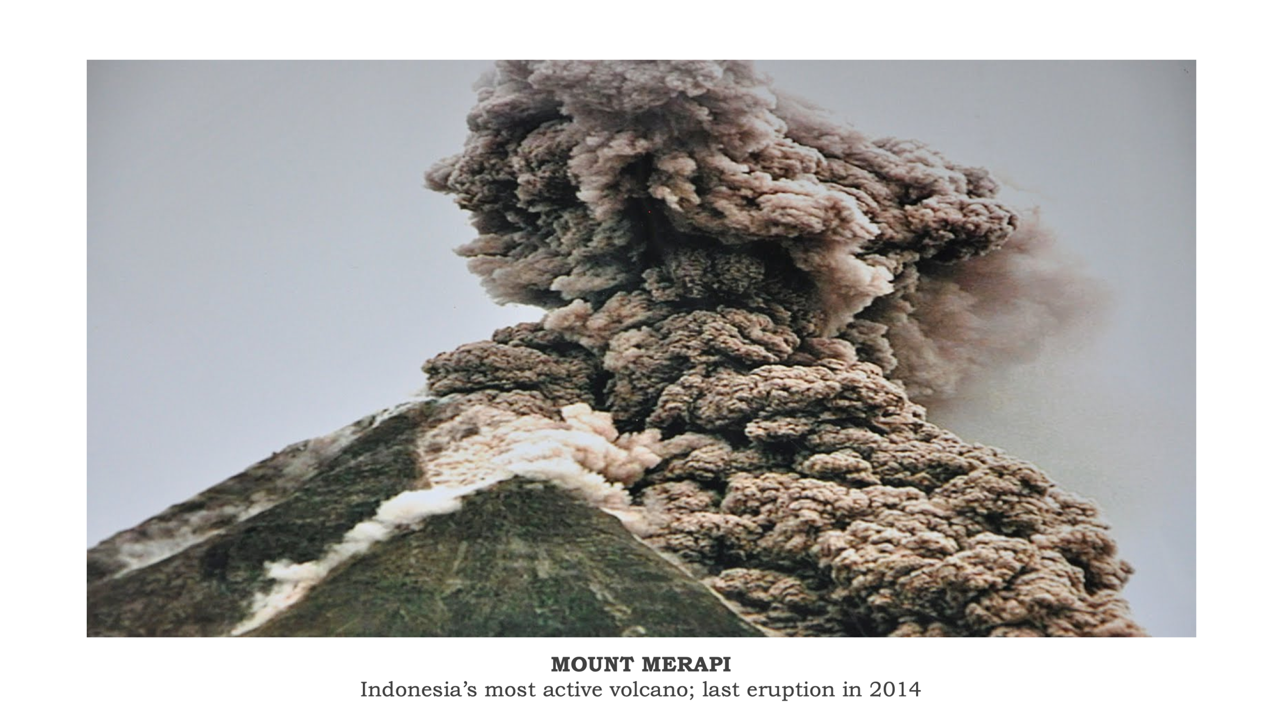
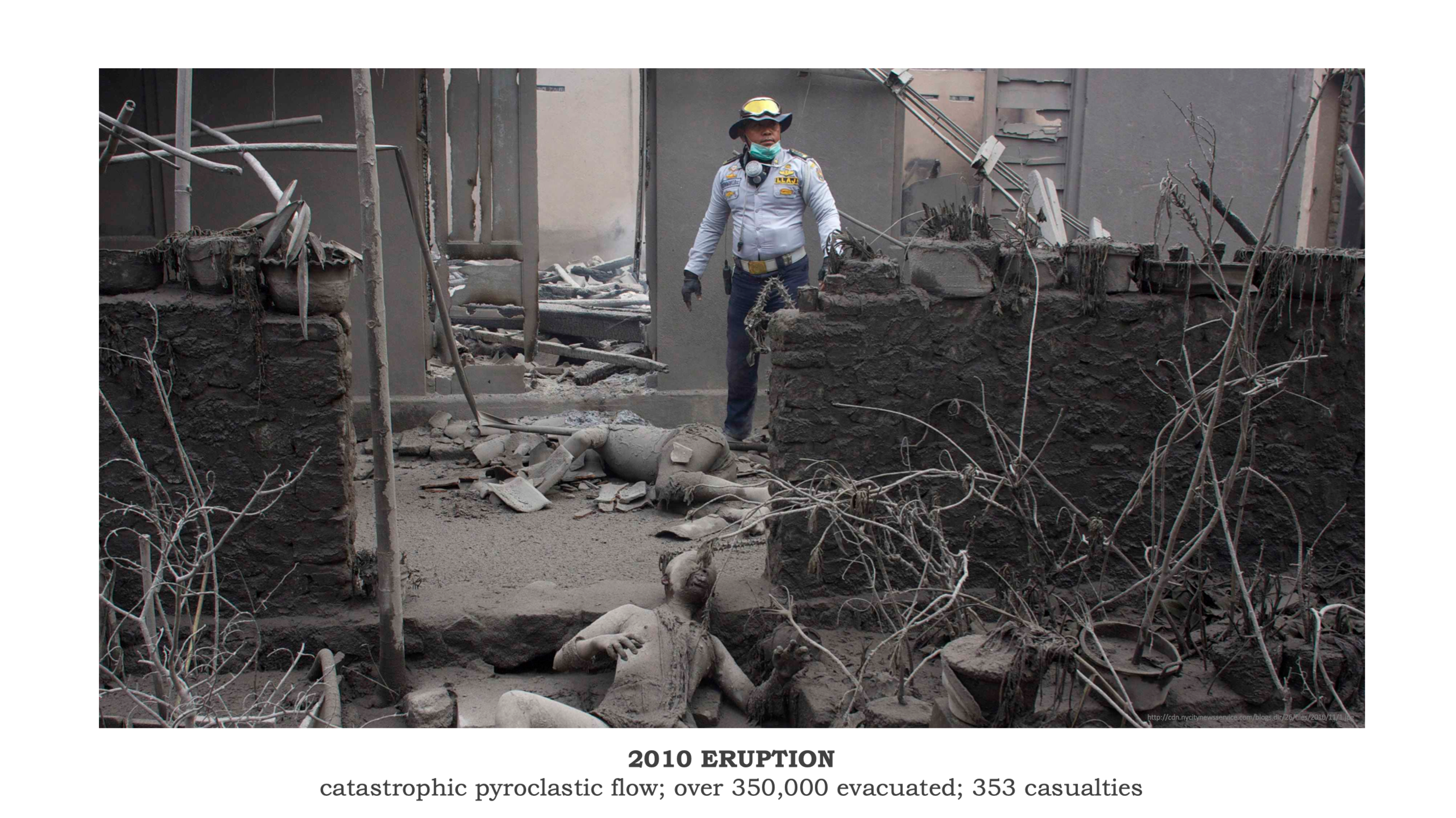
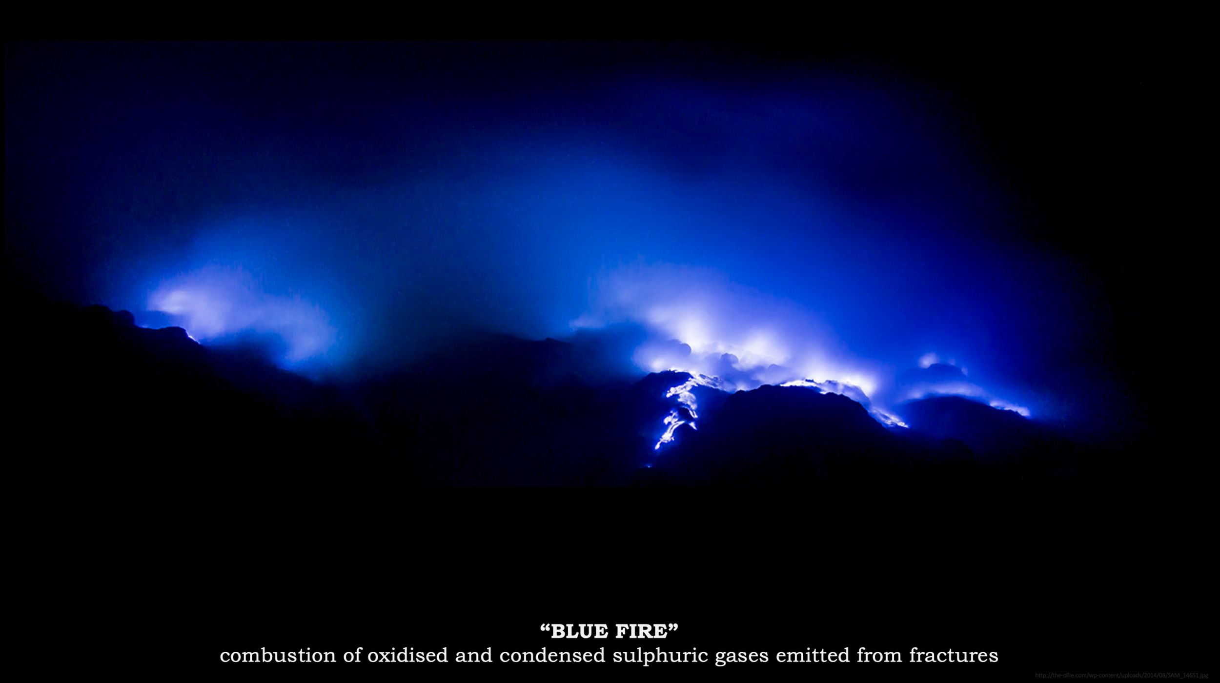
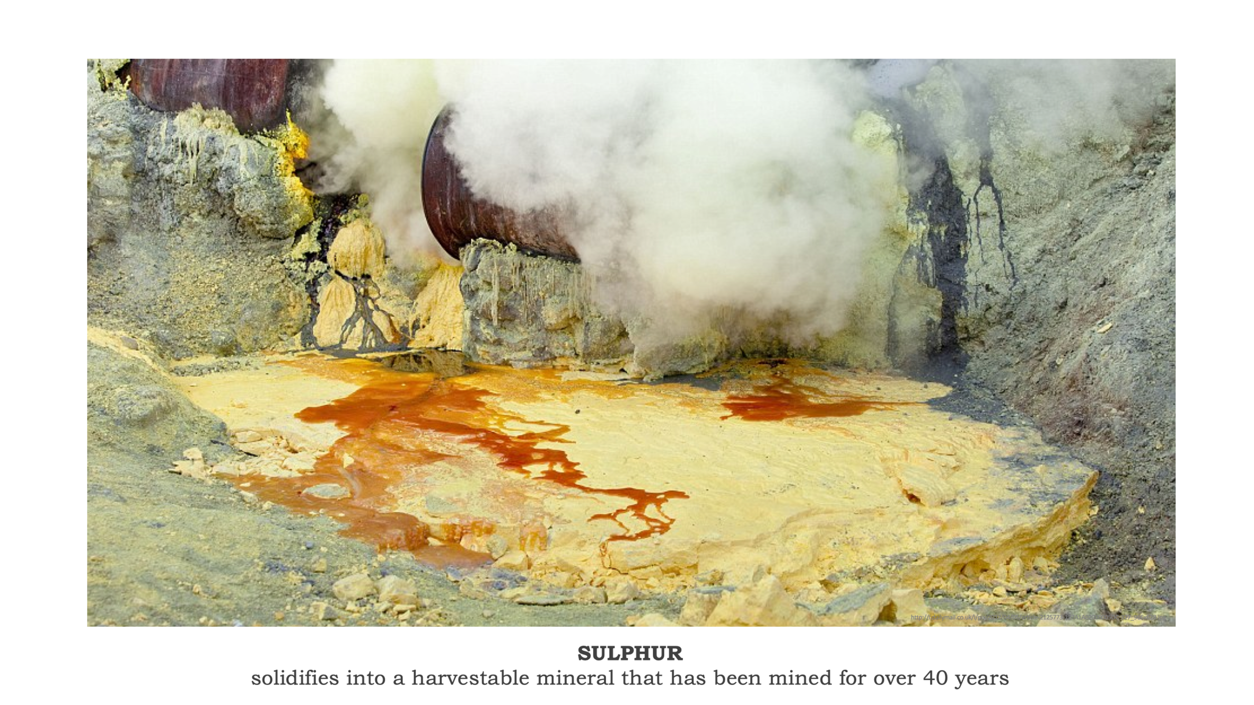
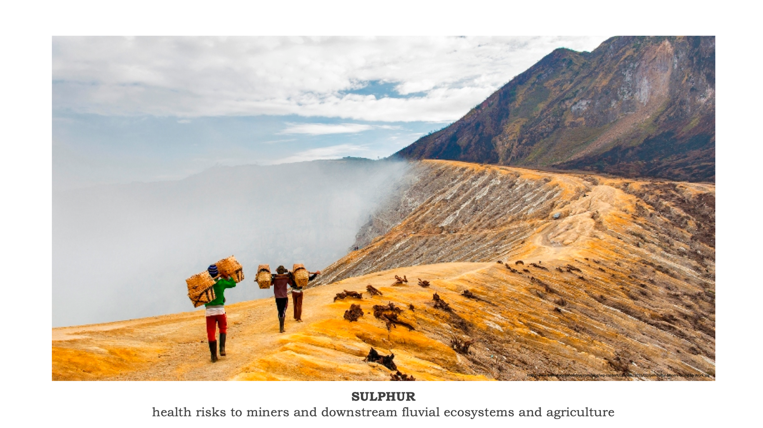
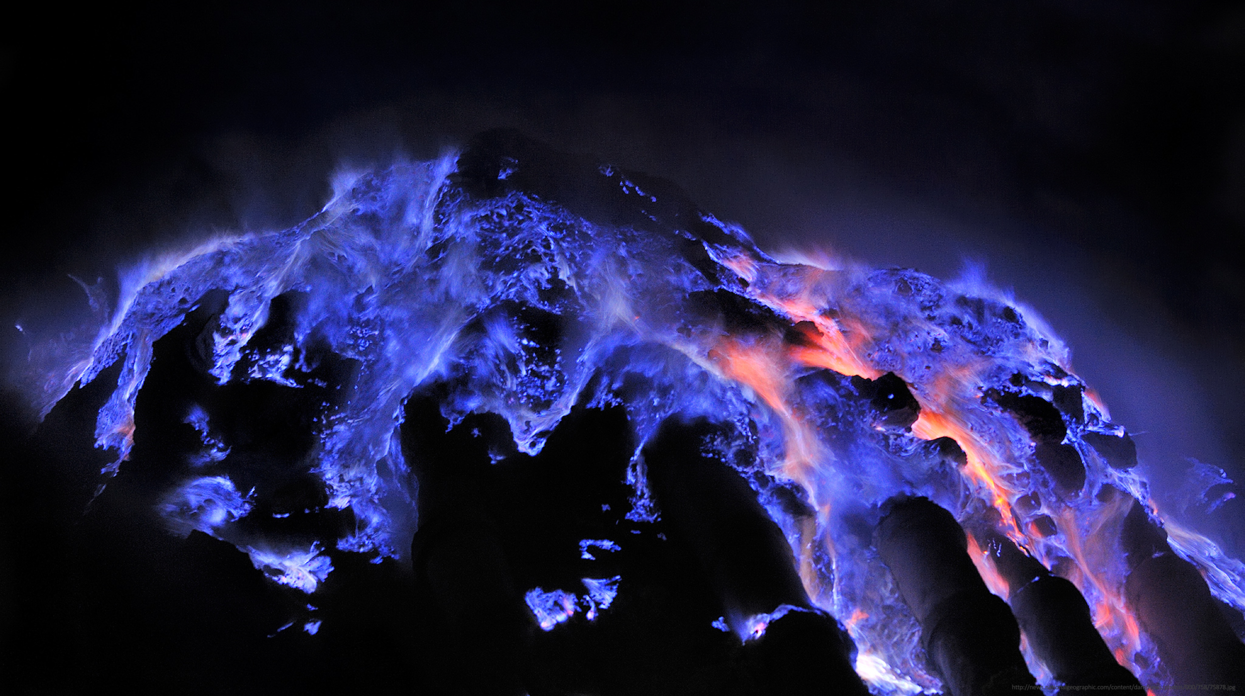
Overview: My group researched and introduced to our class to two volcanoes located in the Ijen volcano complex in East Java, Indonesia. The first, Mount Merapi, is Indonesia’s most active volcano that last erupted in 2014. A notable Merapi eruption occurred in 2010, when catastrophic pyroclastic flow resulted in the evacuation of over 350,000 people and 353 casualties. The second volcano, Kawah Ijen, is known for its highly acidic crater lake and its signature “blue fire” created by the combustion of sulphuric gases emitted from volcanic fractures. The abundance of solidified sulphur in the Kawah Ijen area has also long-attracted sulphur miners, who expose themselves to harmful fumes and risk their health to harvest the mineral to make a living.
Glacial Processes and Geomorphology (3rd-Year Honours)
The University of Edinburgh
Key Terms:
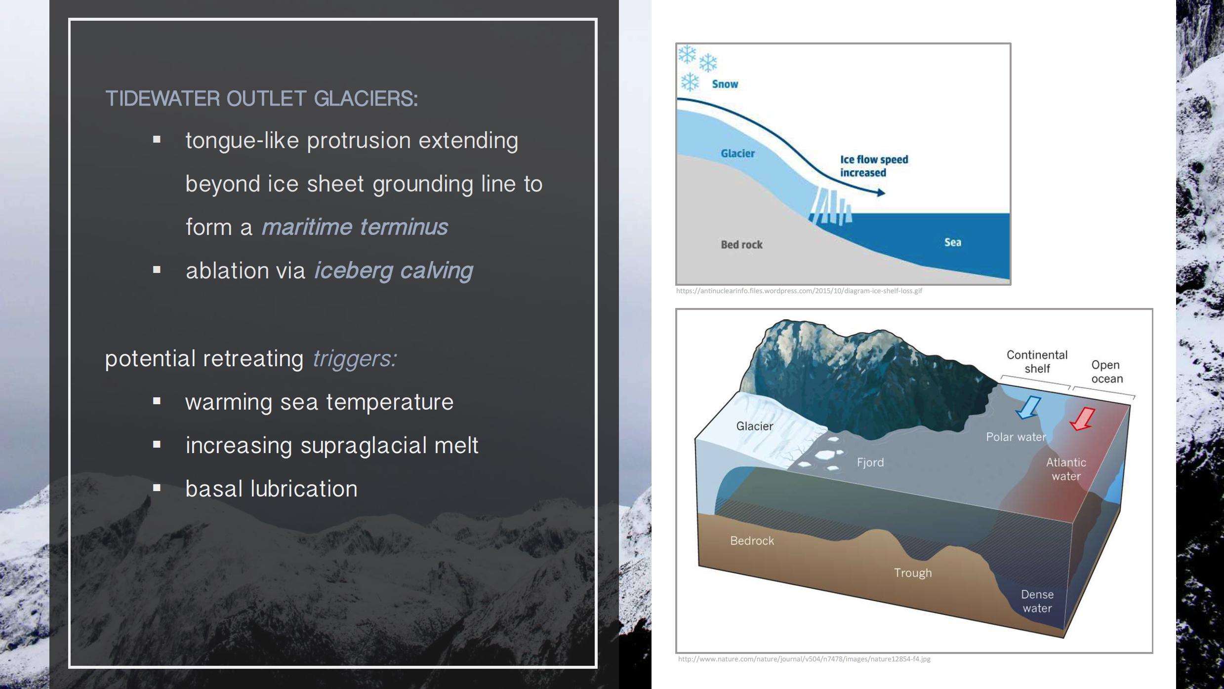
(Tidewater) Outlet Glacier – a tongue-like glacier extending beyond an ice sheet’s grounding line to terminate in a body of water; loses mass via iceberg calving and is sensitive to changes in water temperature and surface melt
Grounding Line – the point at which marine-terminating outlet glaciers (and larger-scale ice shelves) start to float
Retreat – an upstream propagation of a glacier’s terminus due to ice loss (ablation); retreat is not a physical backwards movement of an entire glacier
Acceleration – an increase in the rate of ice flow of outlet glaciers due to the absence of a buttress (such as an ice shelf or ice mélange) at the glacial terminus, resulting in greater ice loss
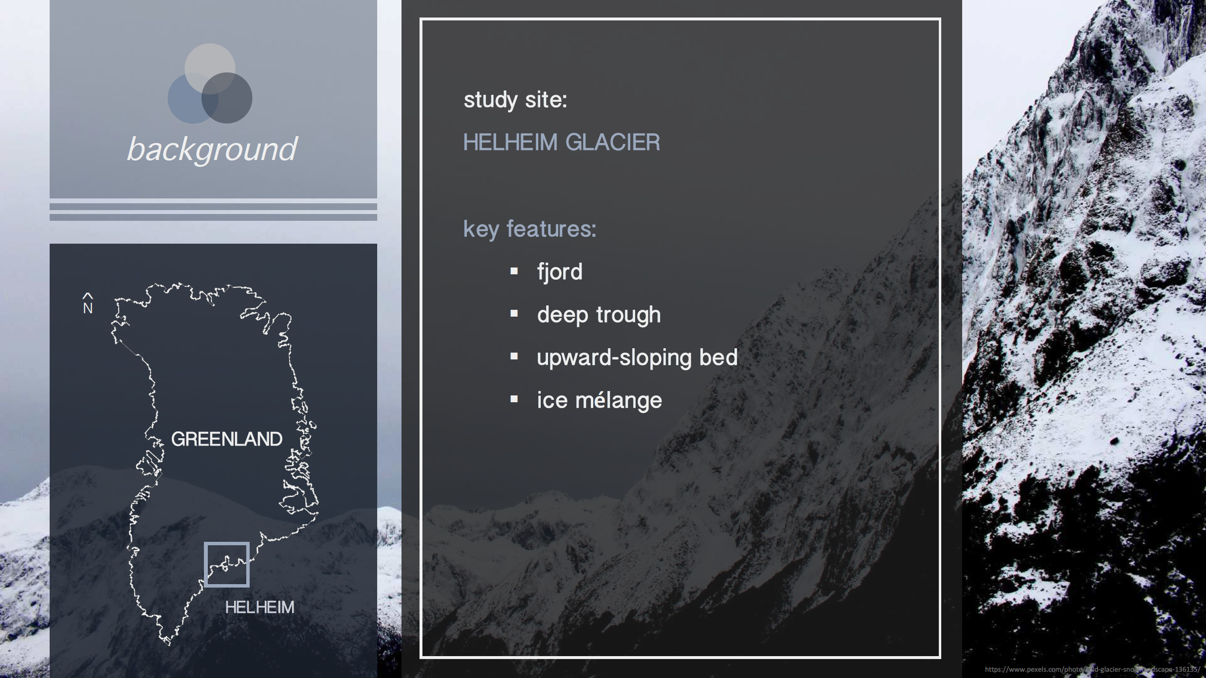
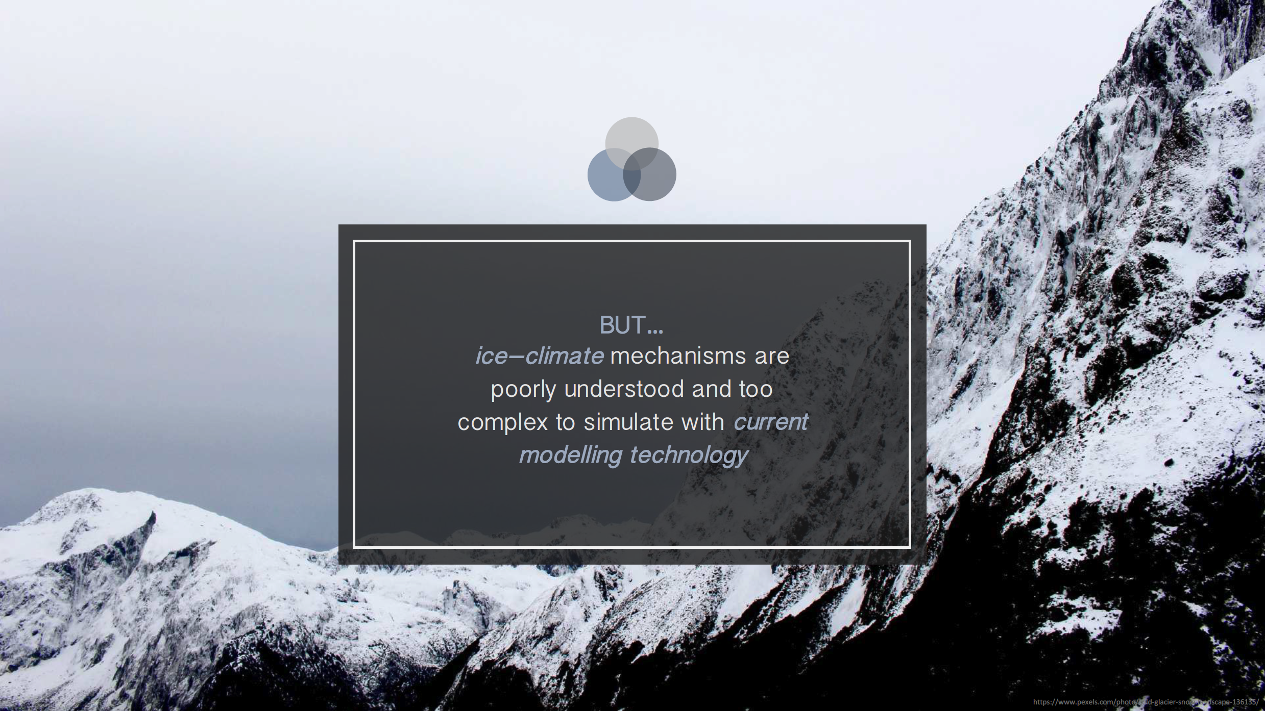
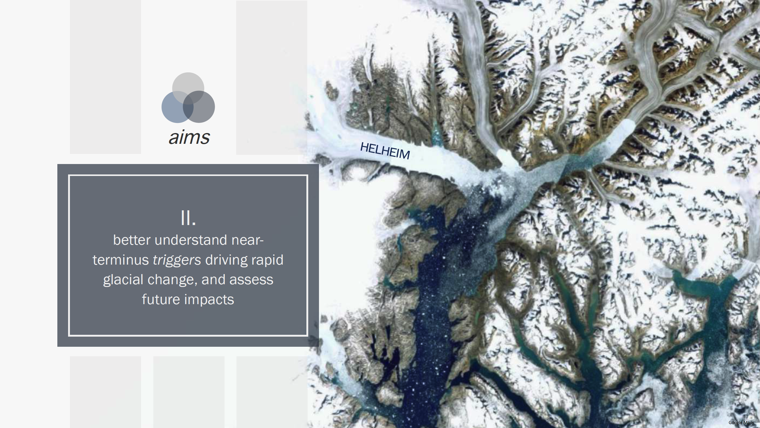
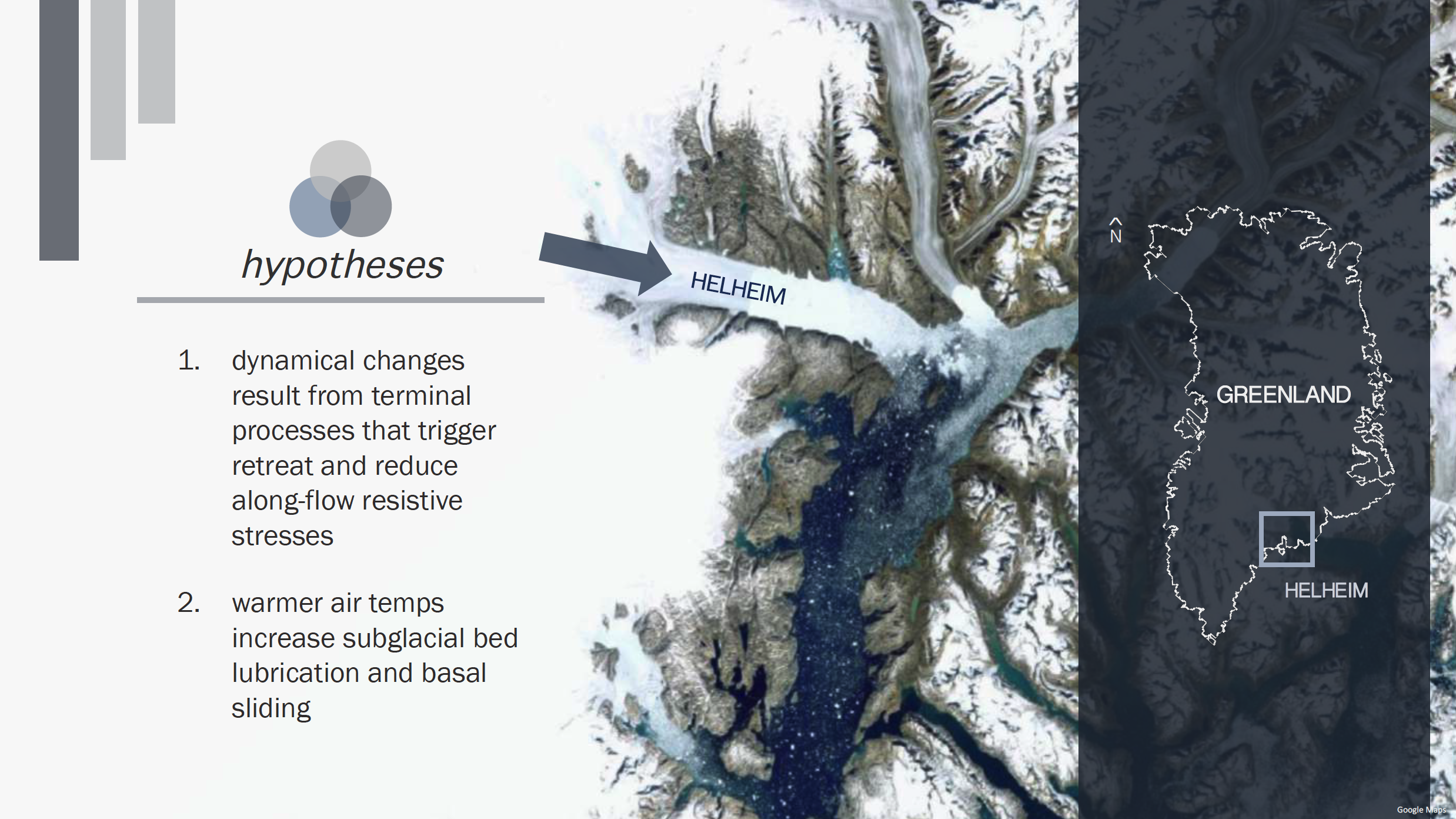
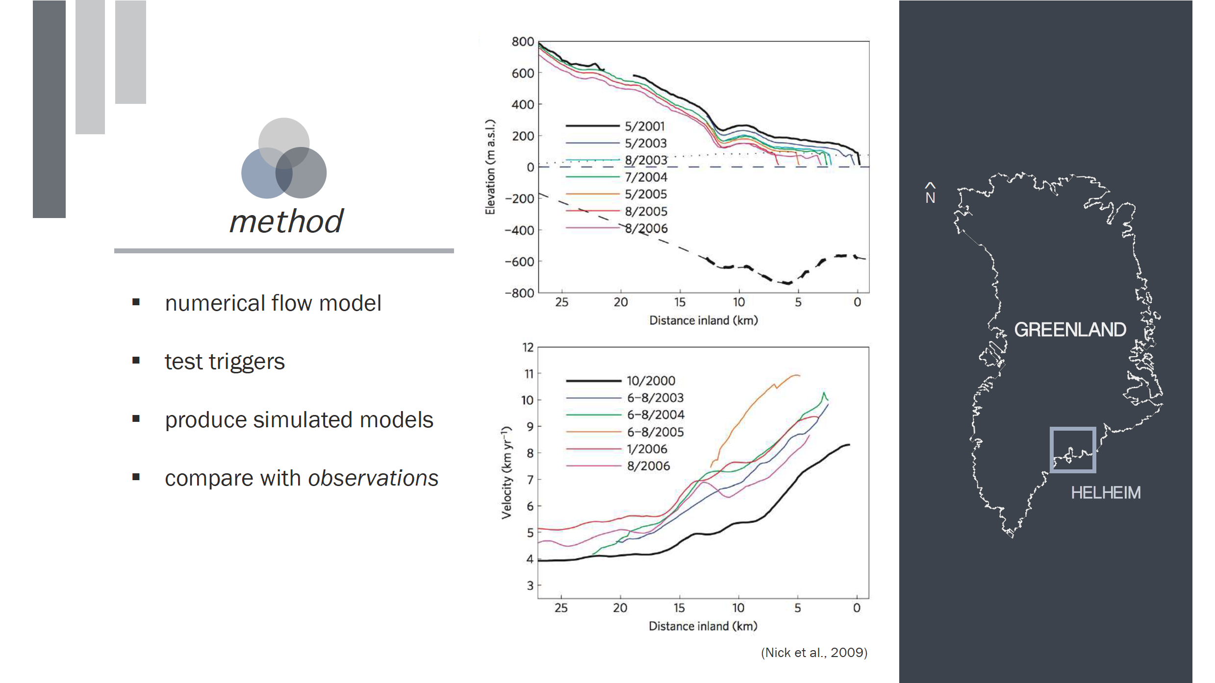
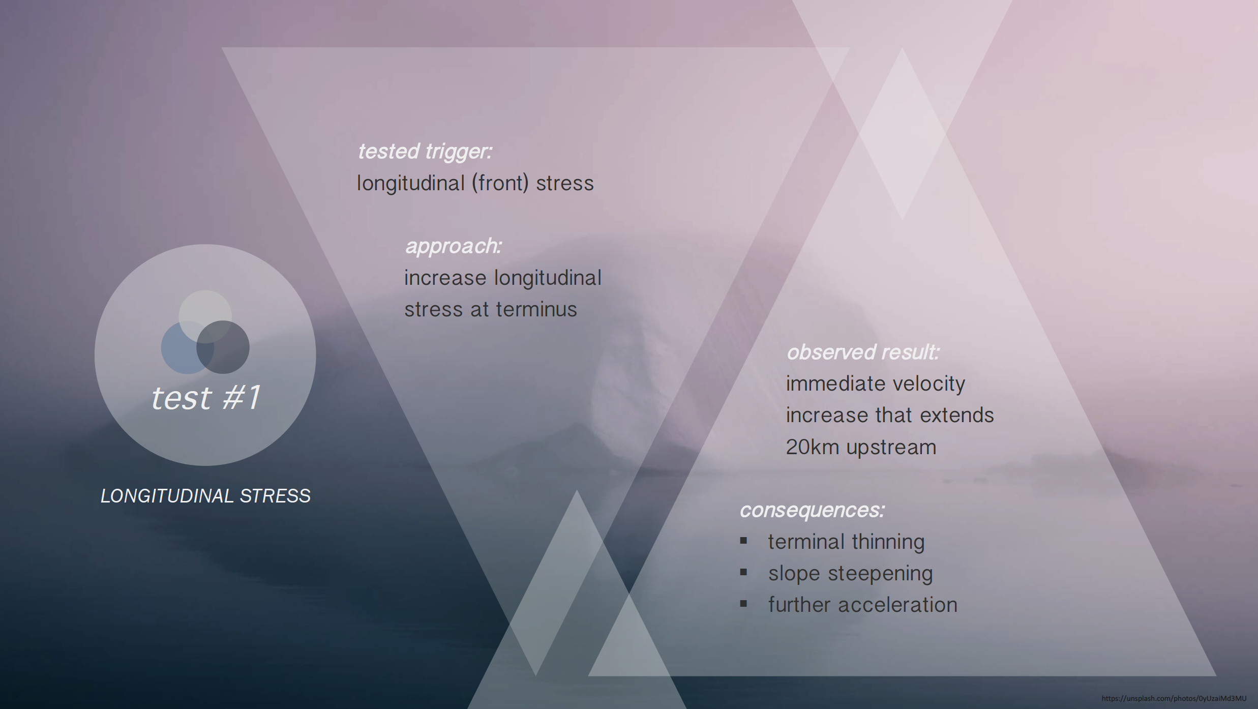
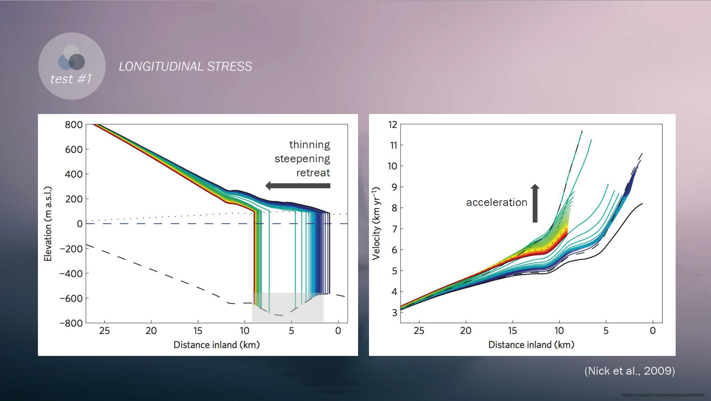
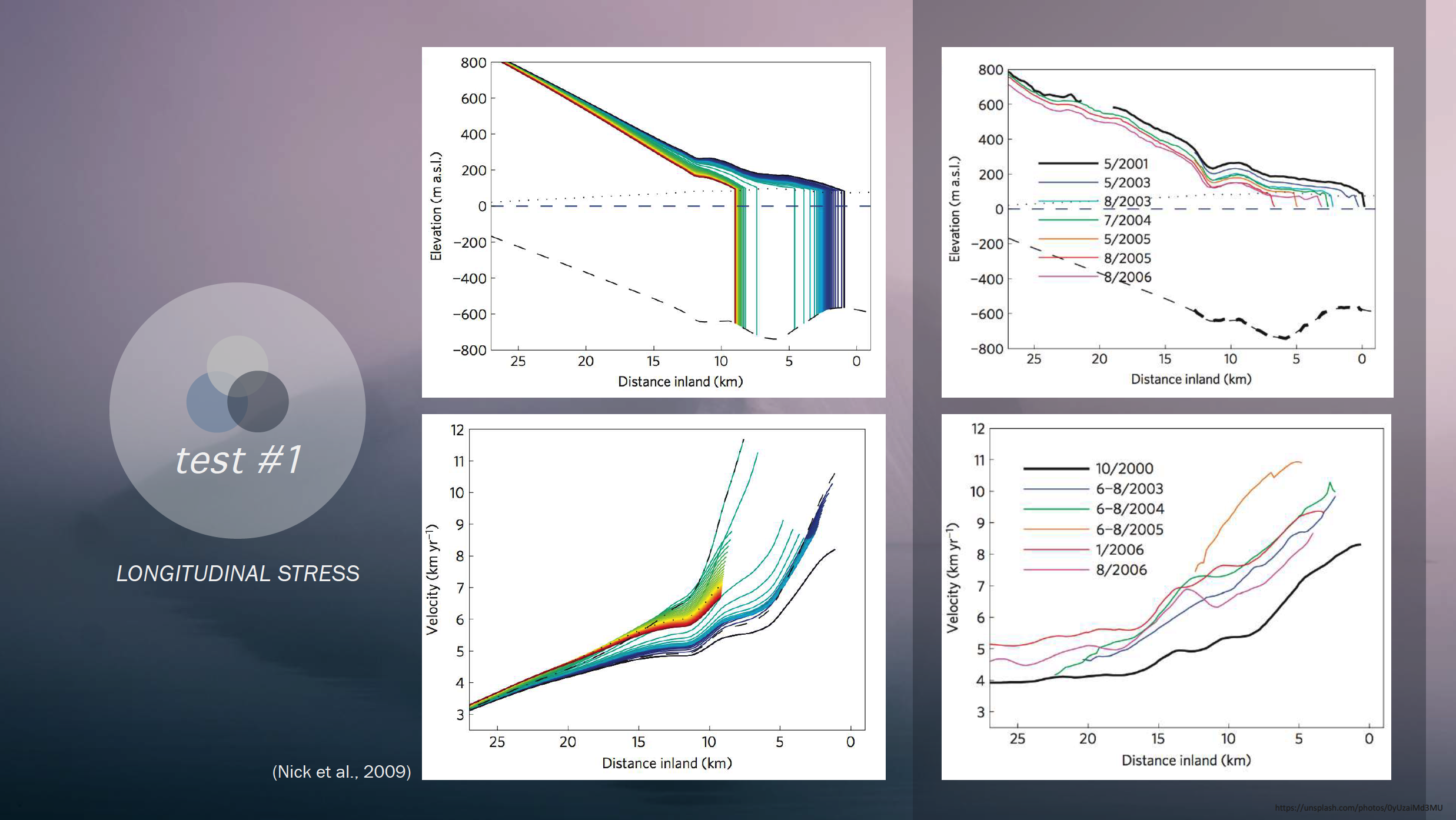
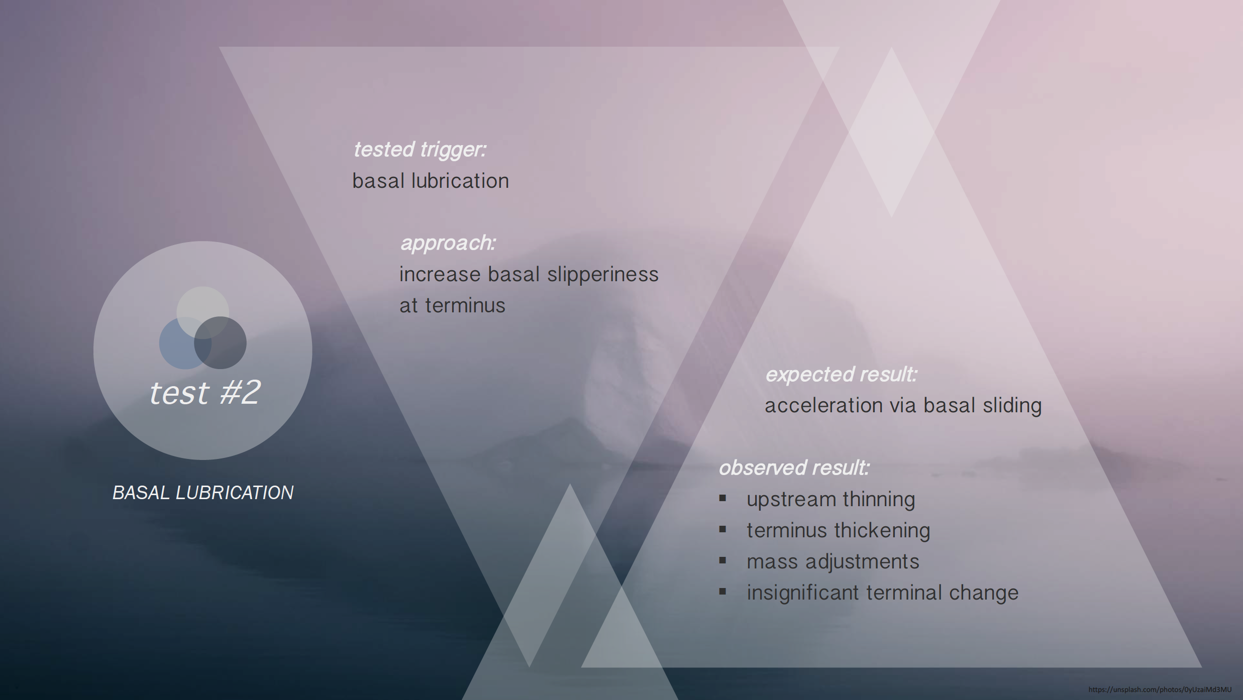
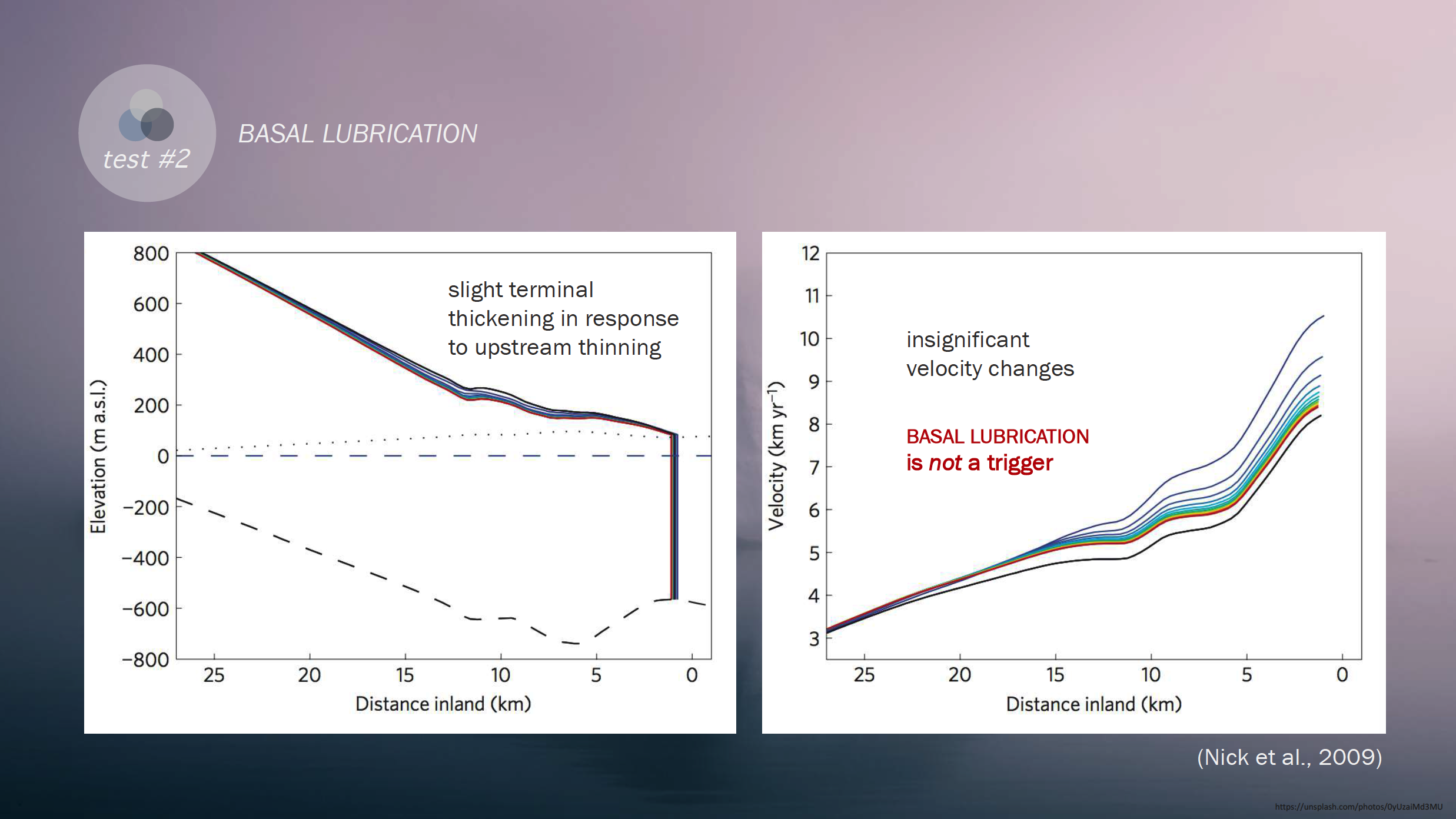
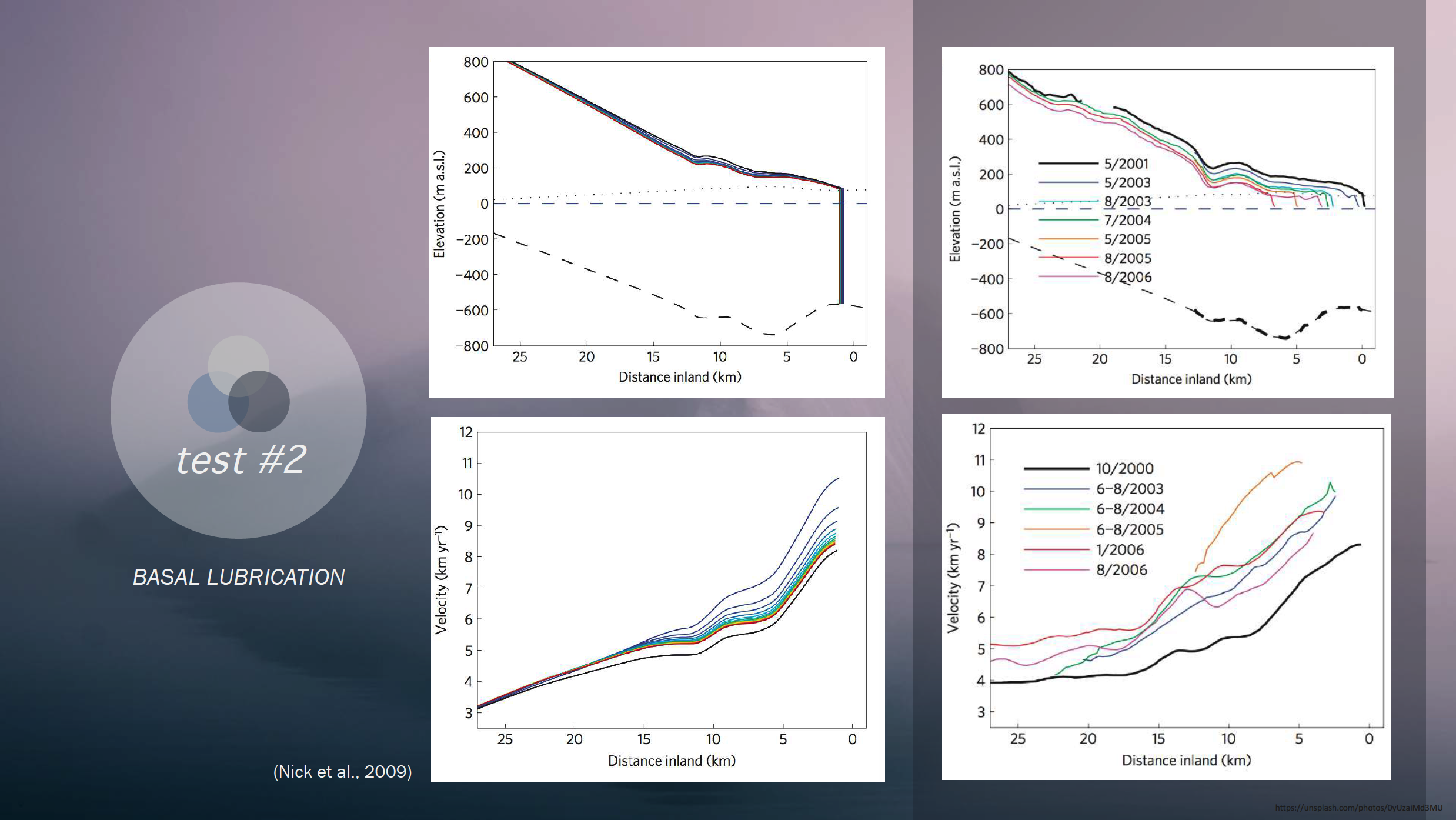
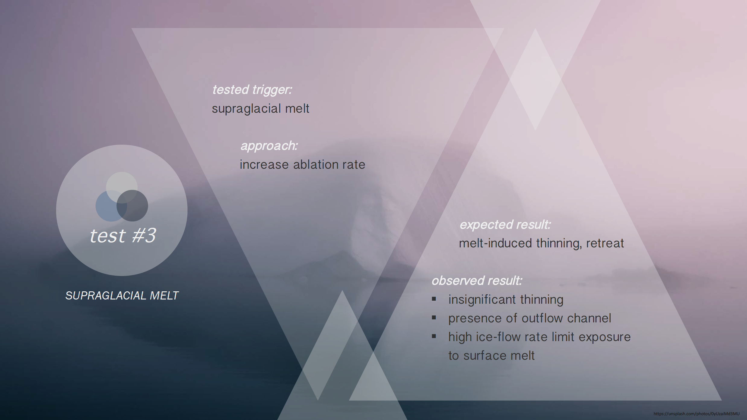
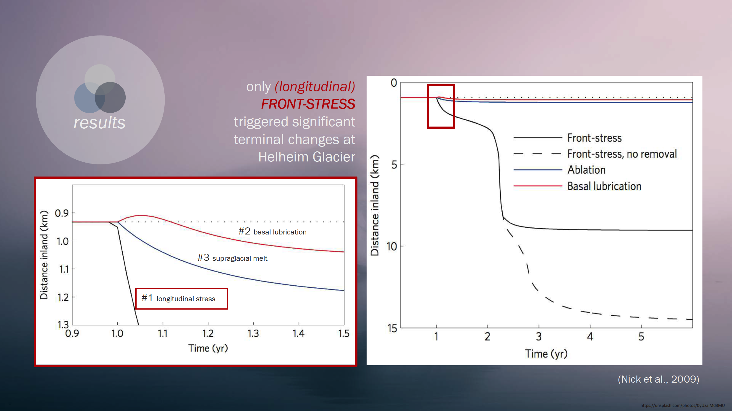
Overview: My group was assigned to examine and interpret the academic paper, titled “Large-scale changes in Greenland outlet glacier dynamics triggered at the terminus”. The main aims of the paper were 1) to highlight the complexity of outlet glacier systems, specifically pertaining to ice-climate interactions, and challenges to modelling their behaviour; 2) emphasise the importance of better understanding possible near-terminus triggers of rapid change. These aims, along with other glaciological research, stem from a common goal of furthering our knowledge of how various environmental and anthropogenic components respond and influence each other.
Qualitative Methods in Geography (3rd-Year Honours)
The University of Edinburgh
Key Terms:
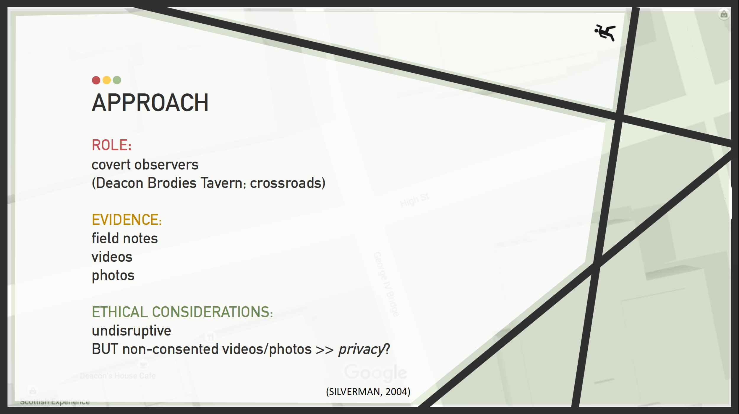
Covert Observation – when a researcher joins a group of participants without the participants knowing they are being studied; usually conducted to gain greater access to evidence
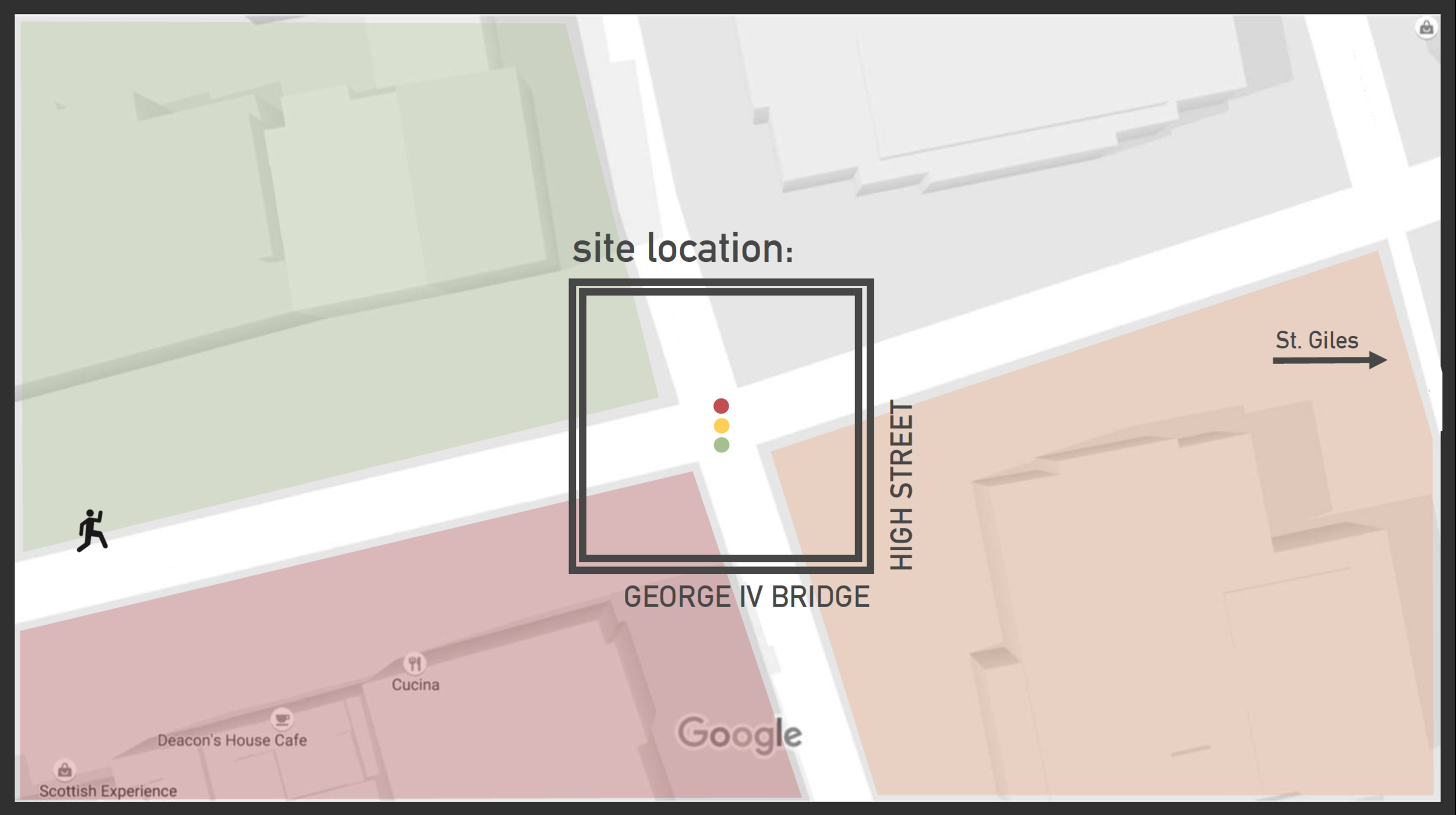
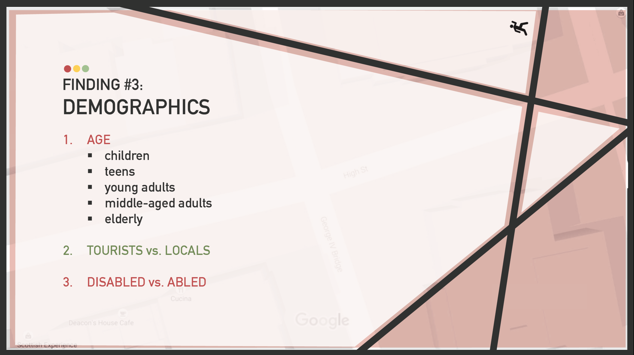
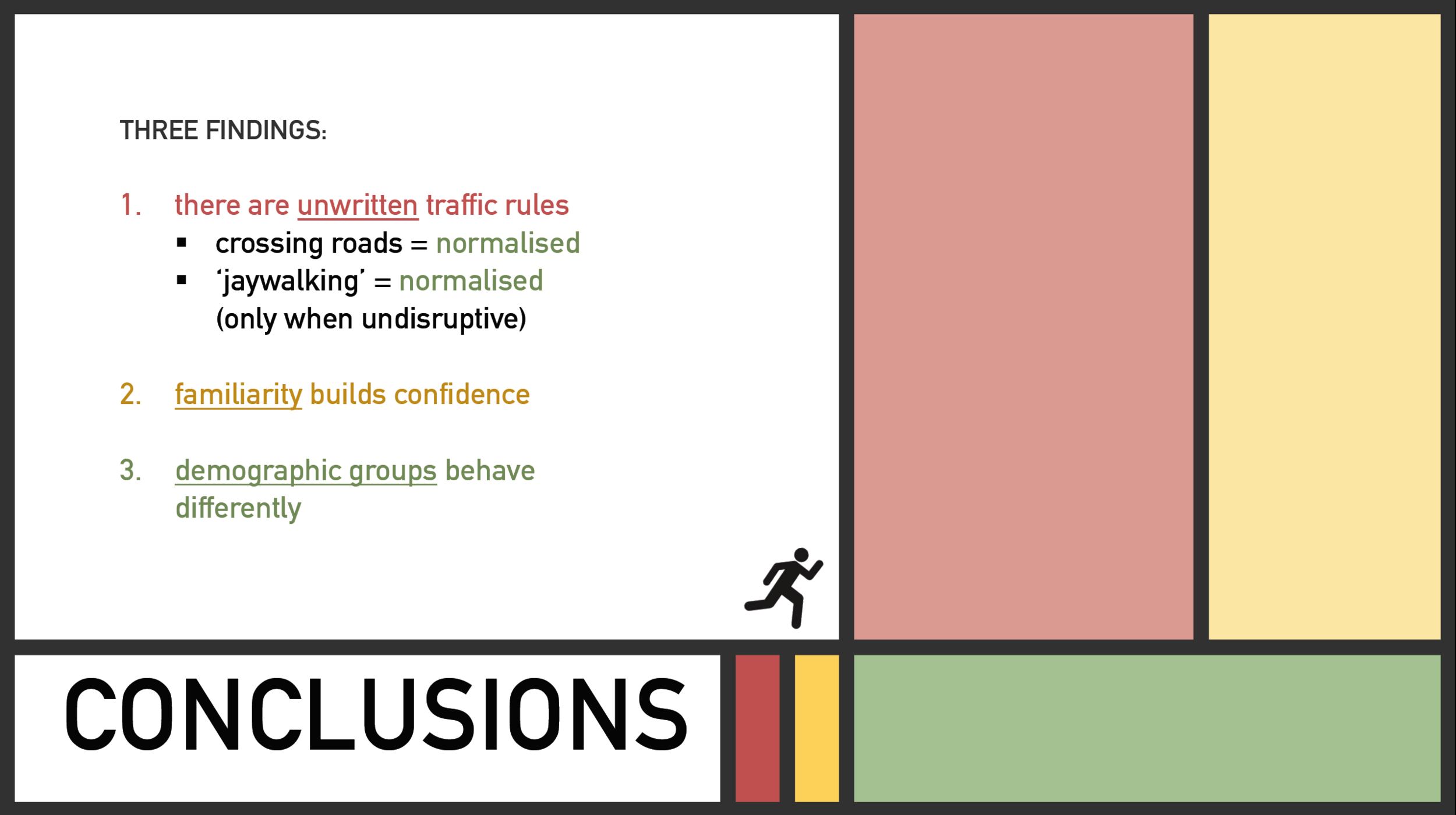
Overview: For this social experiment, my group decided to examine the everyday practice of crossing roads. Our study site was the crossroad at George IV Bridge and High Street in Edinburgh’s Old Town district and to collect data, we assumed the role of covert observers to investigate how pedestrians navigate the streets and negotiate traffic. We, ultimately, concluded with three key findings: 1) there are unwritten traffic rules (such as minimising disruption to traffic when attempting to jaywalk); 2) familiarity with the local traffic rhythm and system is reflected in the confidence with which some people jaywalk; and 3) certain demographic groups are more comfortable crossing than others.
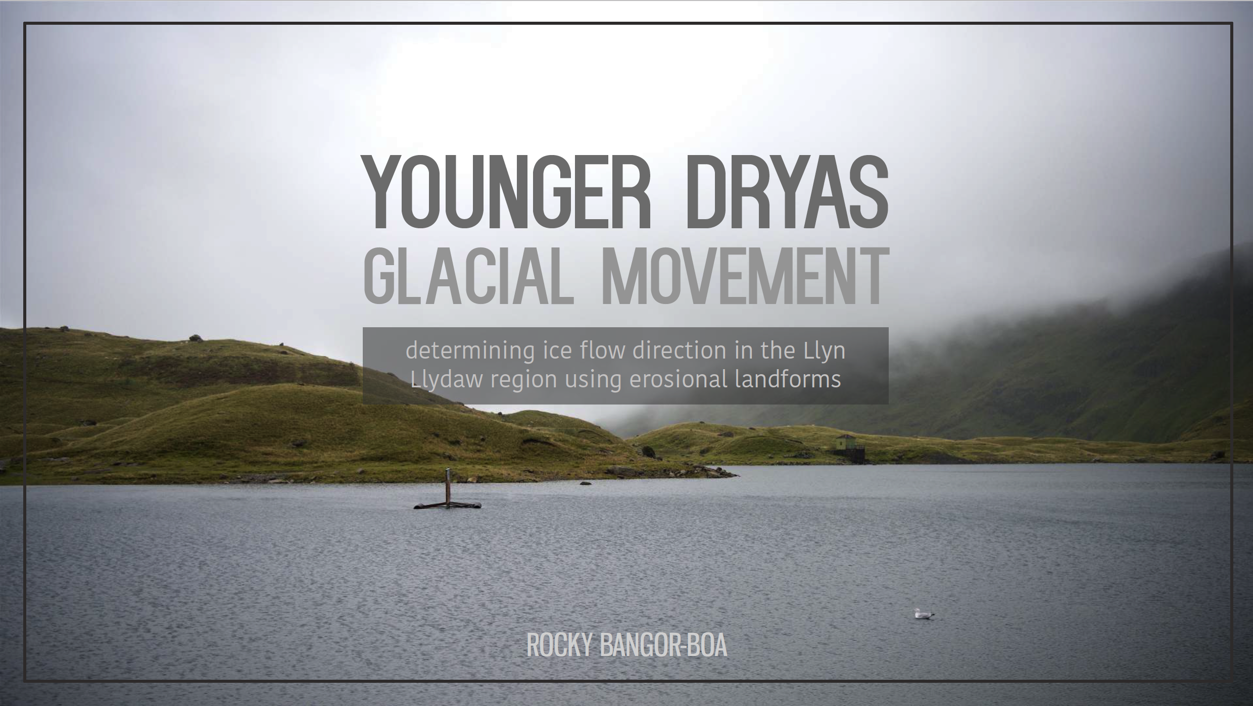
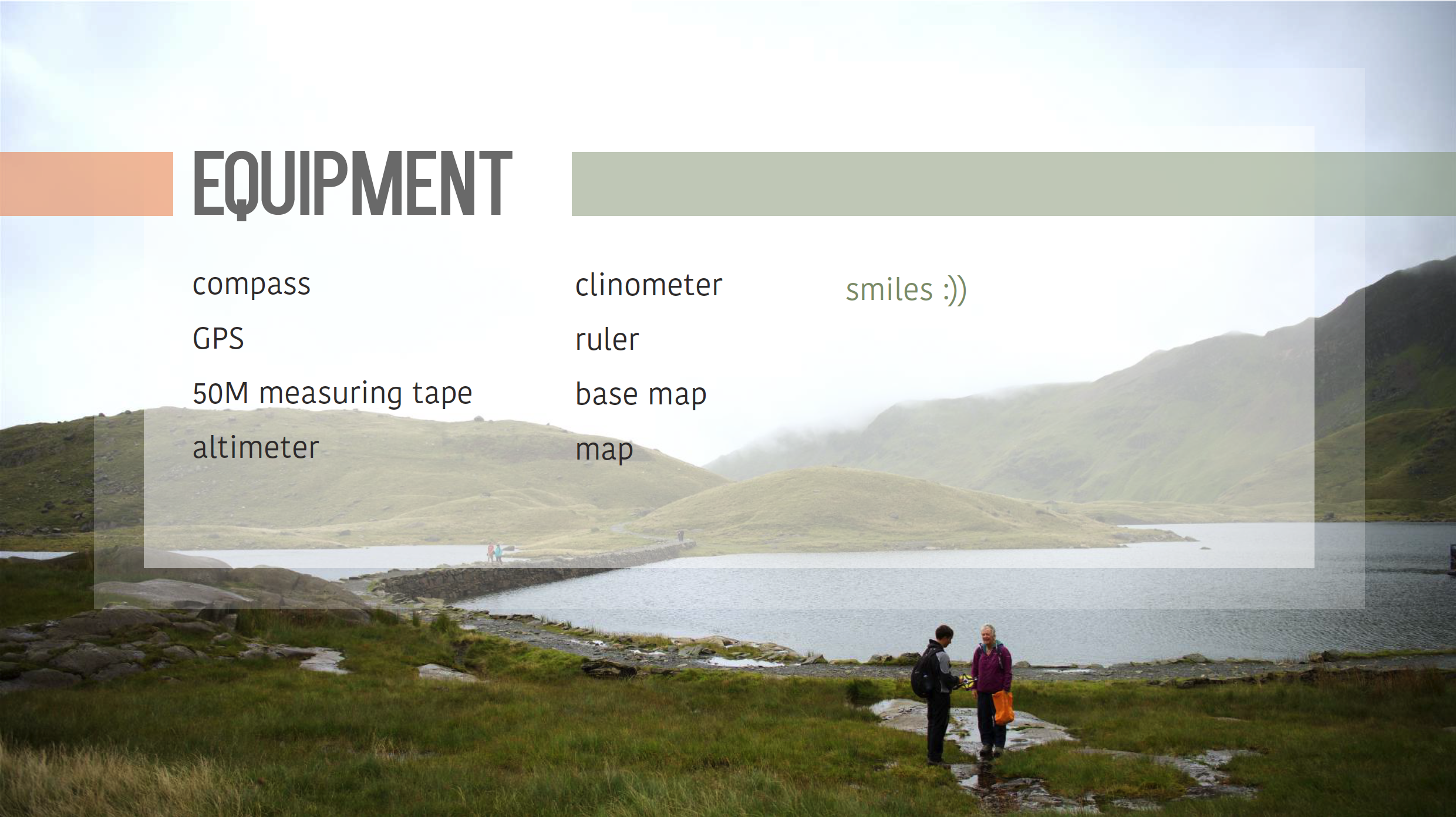
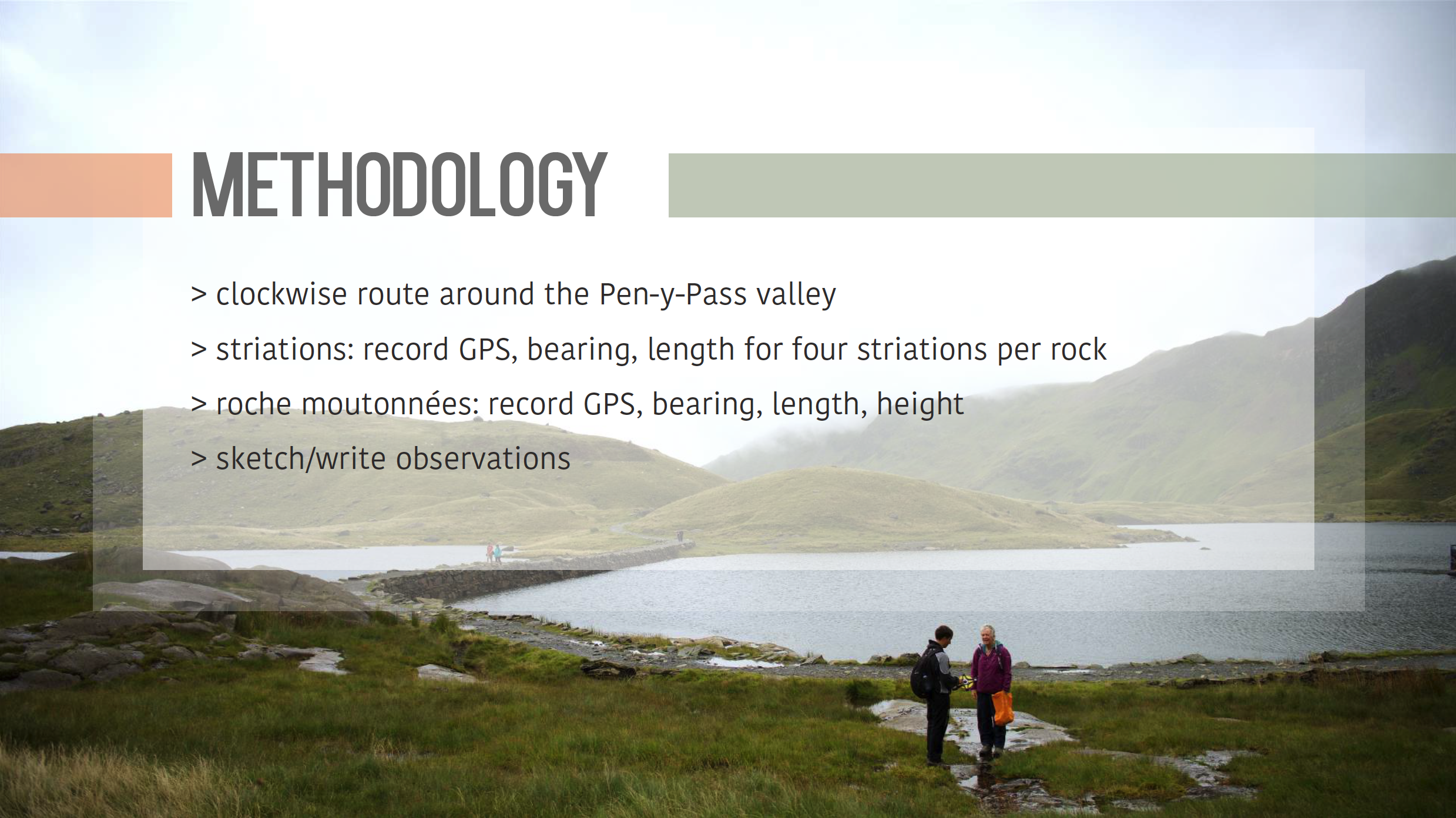
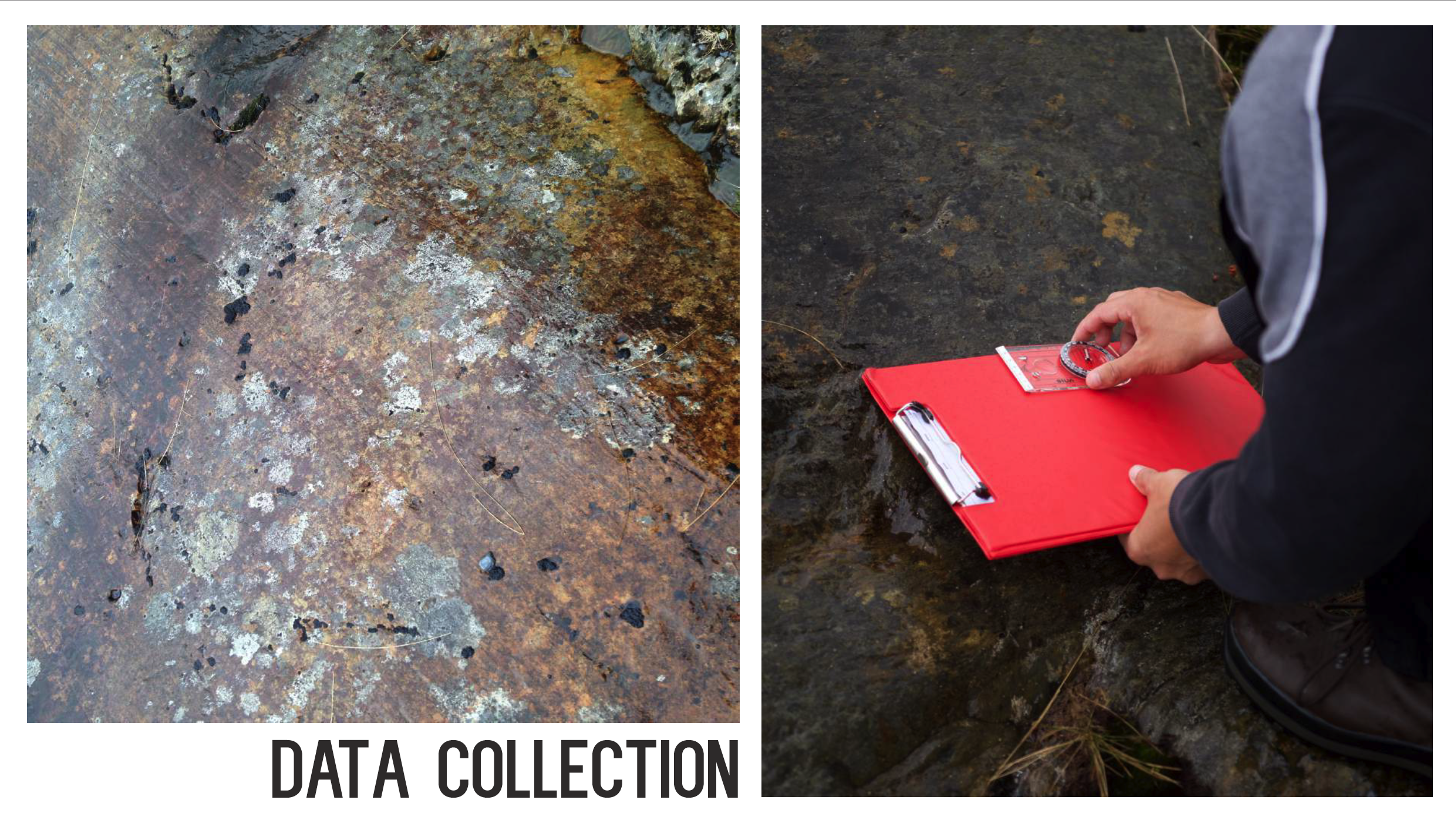
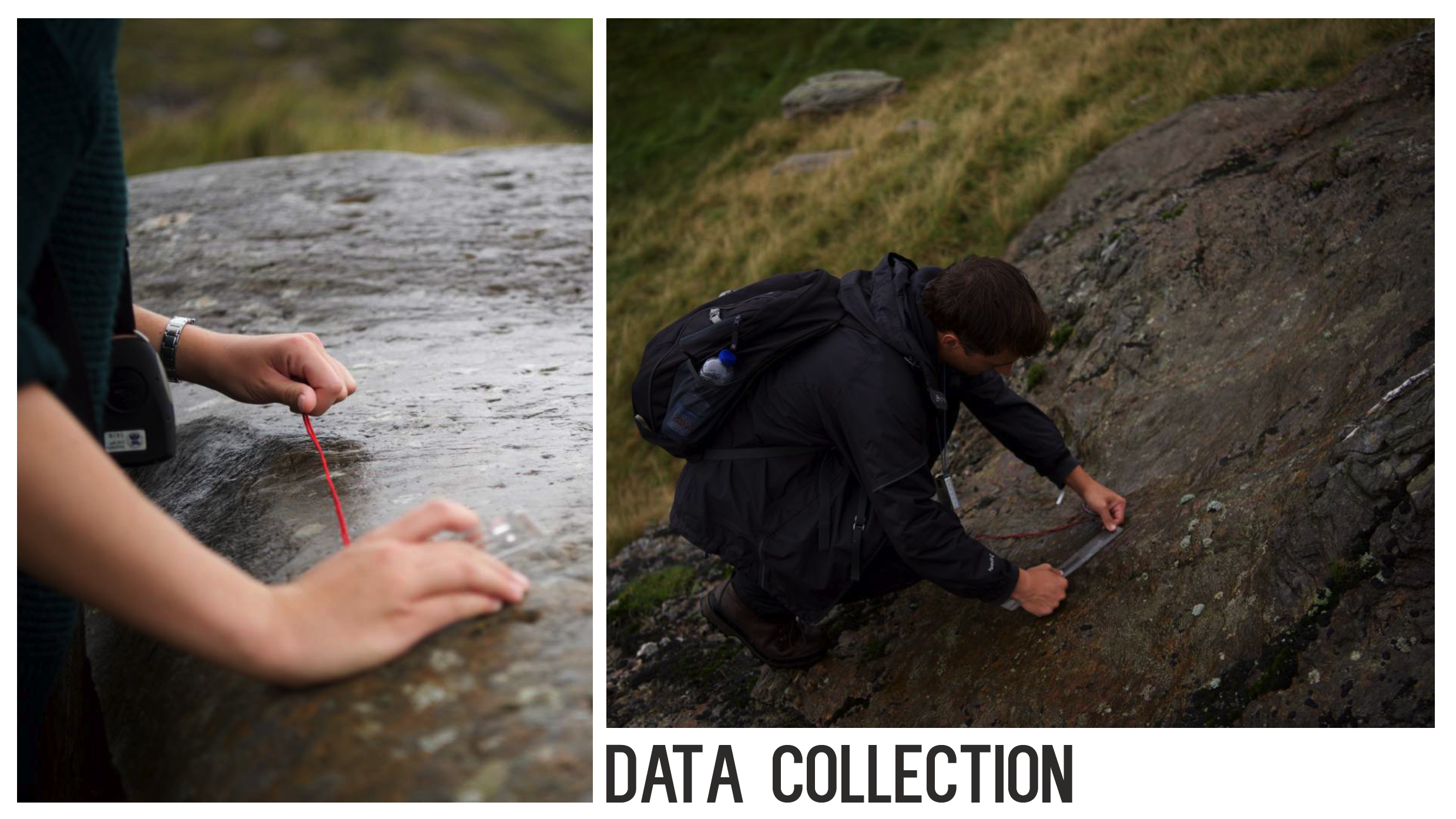
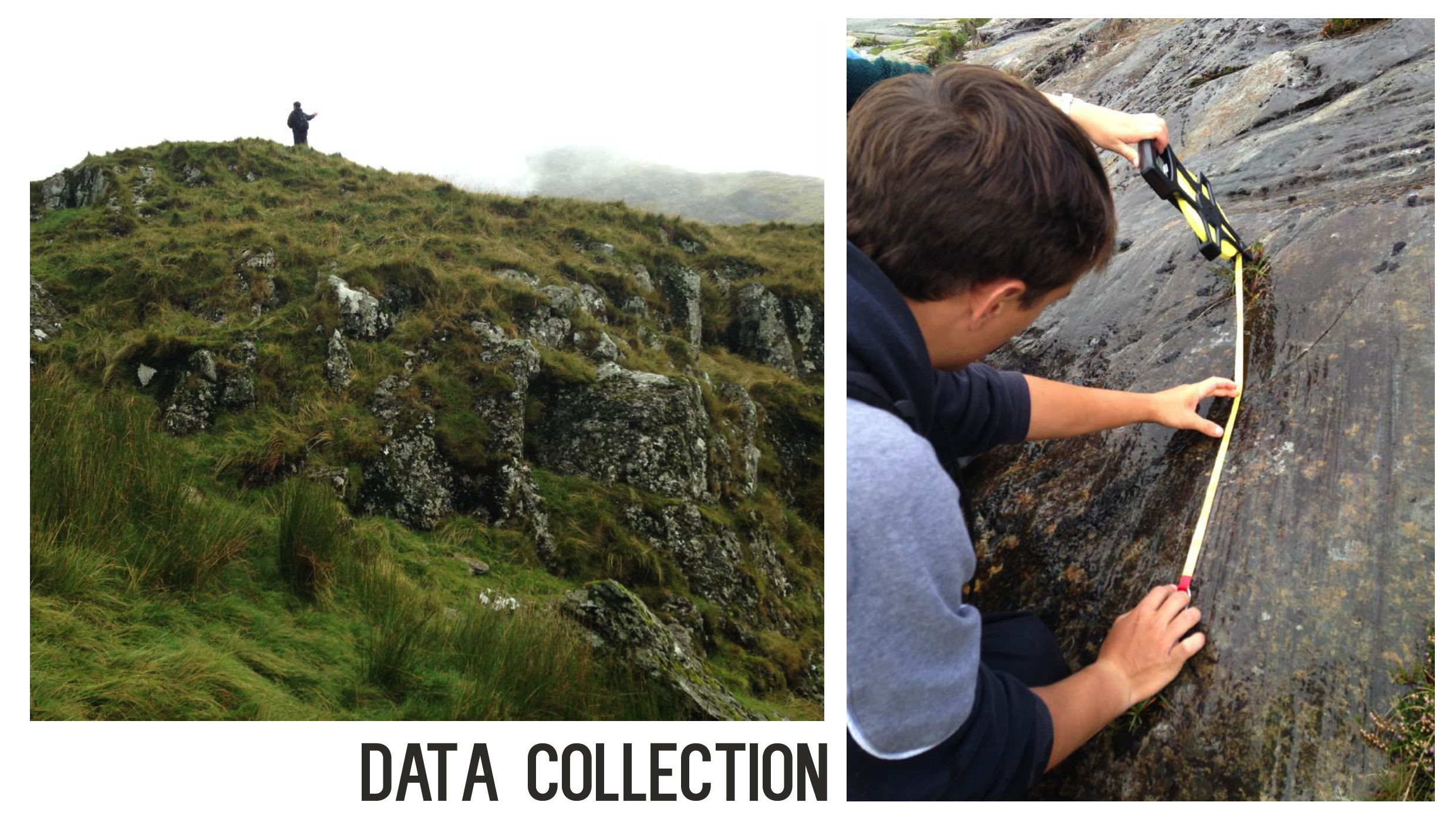
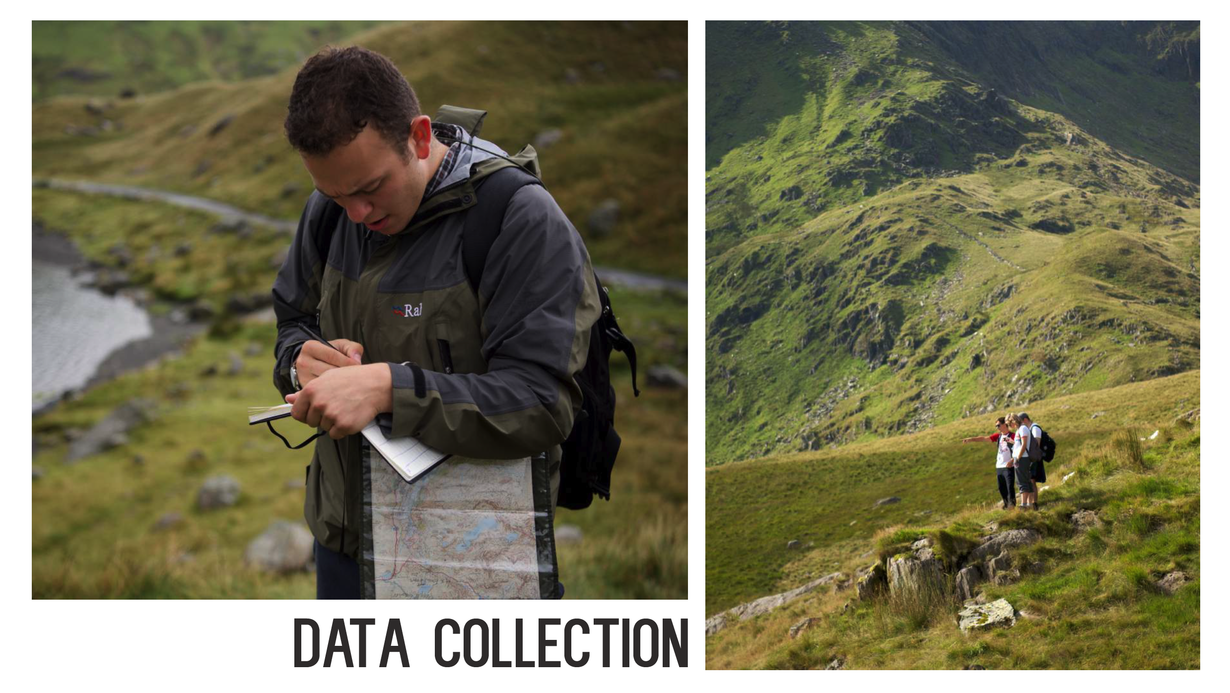
Physical Geography Fieldwork (Snowdonia, Wales)
The University of Edinburgh
Key Terms:
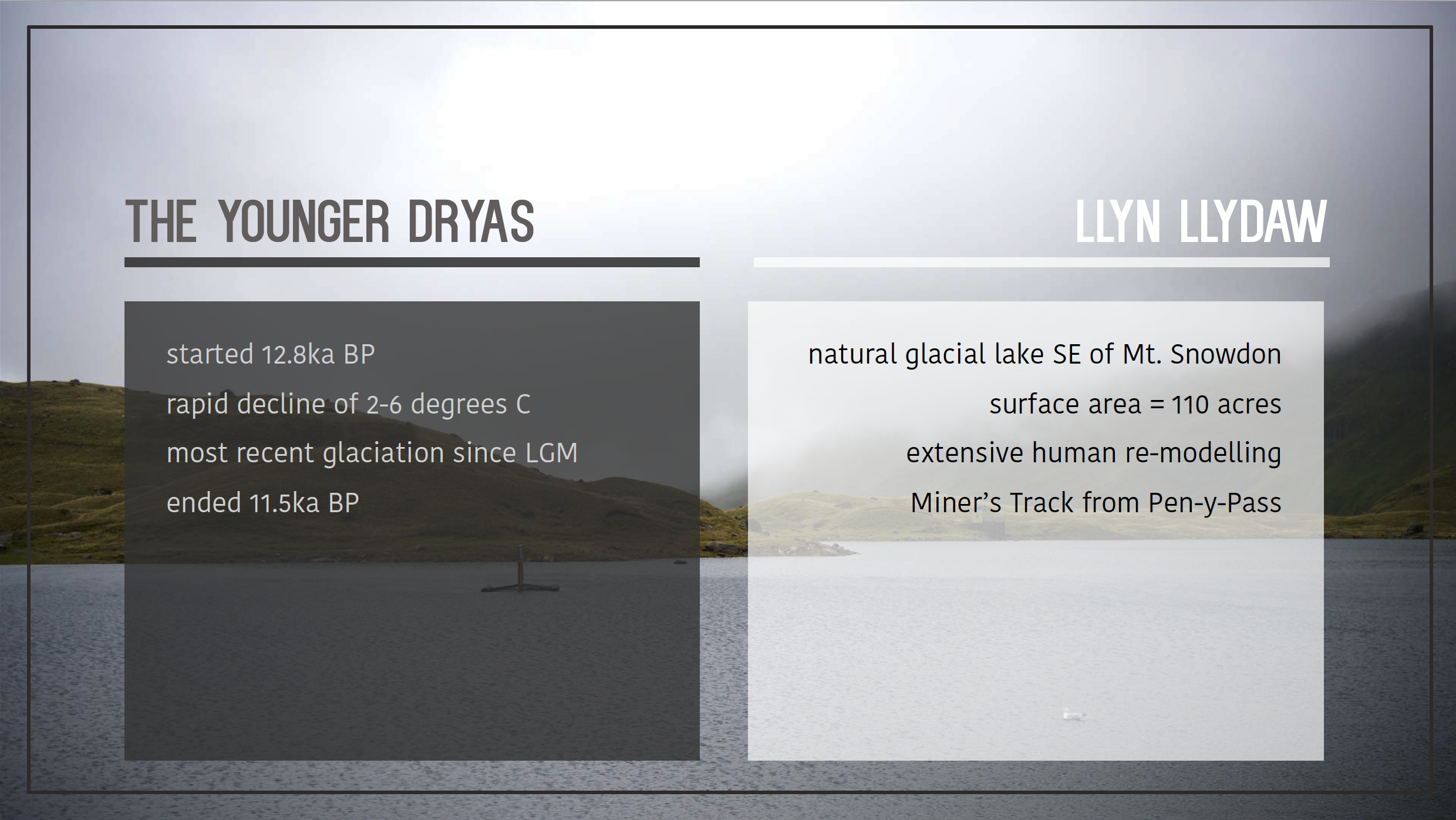
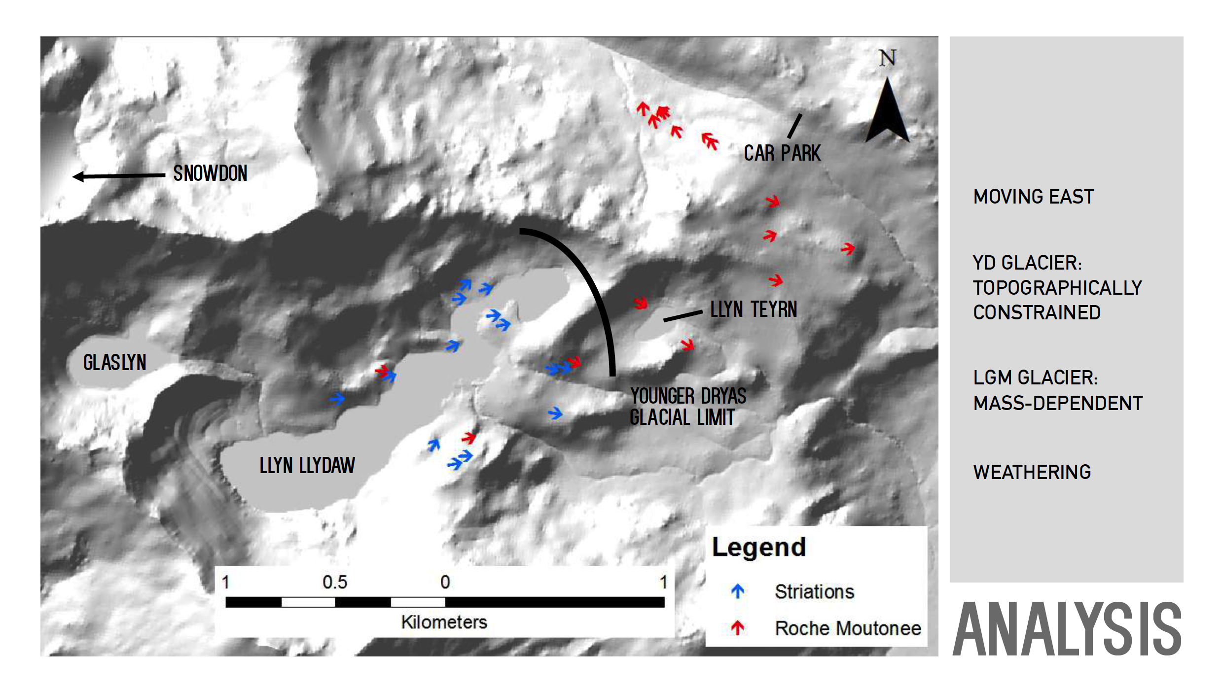
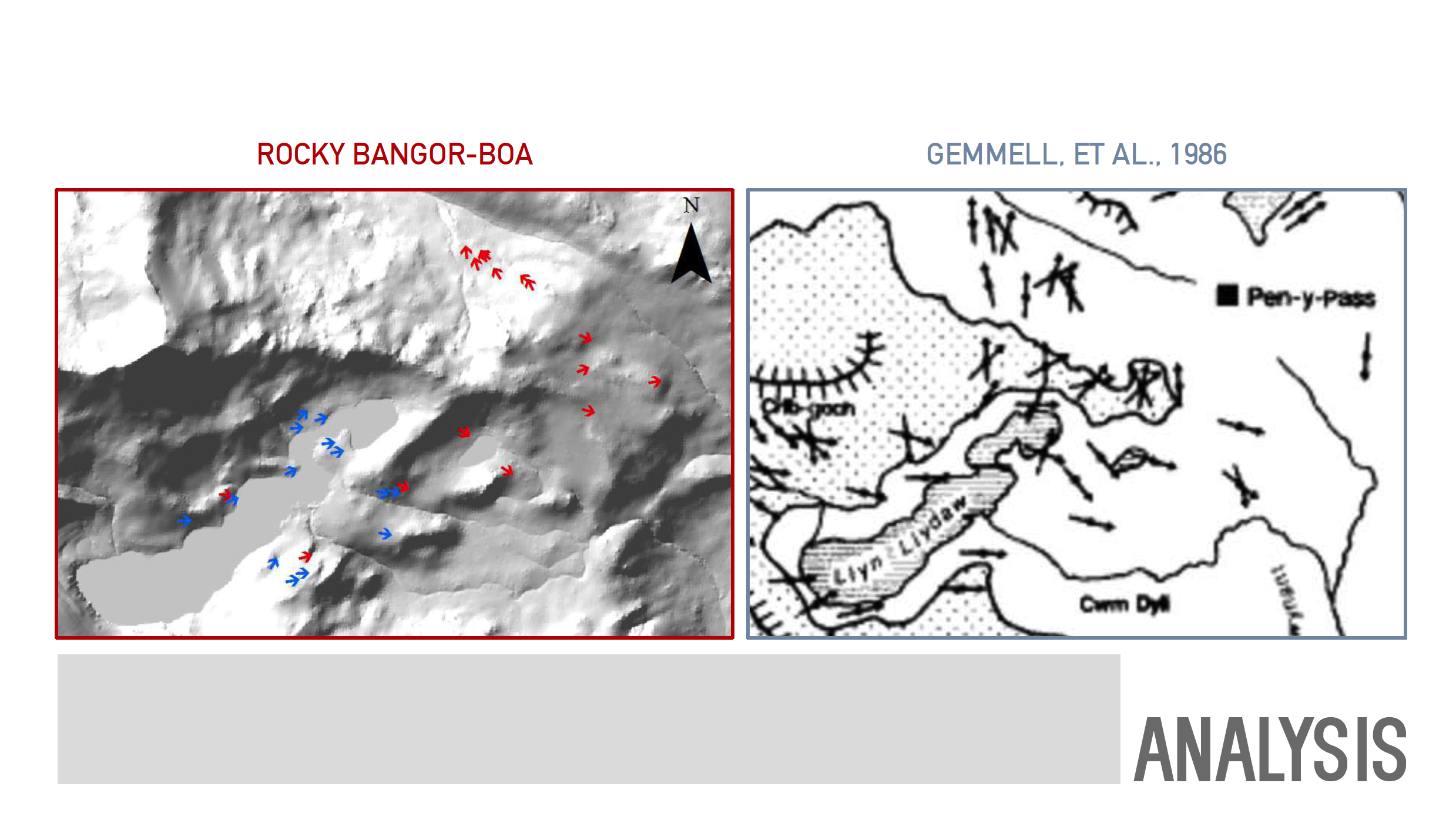
Younger Dryas – a period of glaciation that occurred ~13,000 years ago
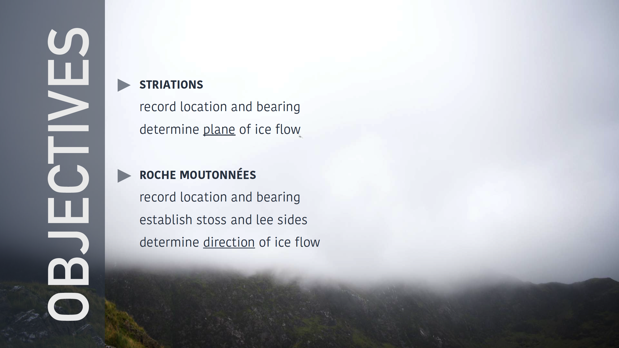
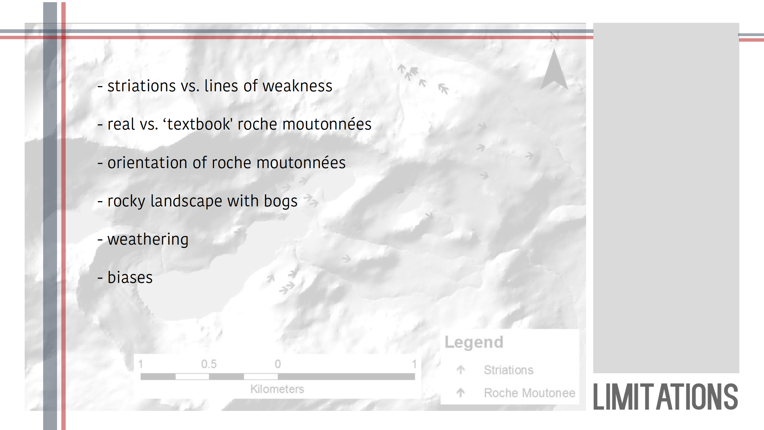
Striations – small-scale linear marks on rocks from abrasive contact; indicates the planar direction along which ice over-rode rock (i.e.: east-west, north-south)
Roches Moutonnées – large-scale mound-like features with a gently sloping side that ends sharply with a cliff side; orientation of sloped side indicates direction of ice-flow
Last Glacial Maximum – a period of widespread glaciation that occurred ~26,500 years ago, during which ice sheets reached their greatest extent
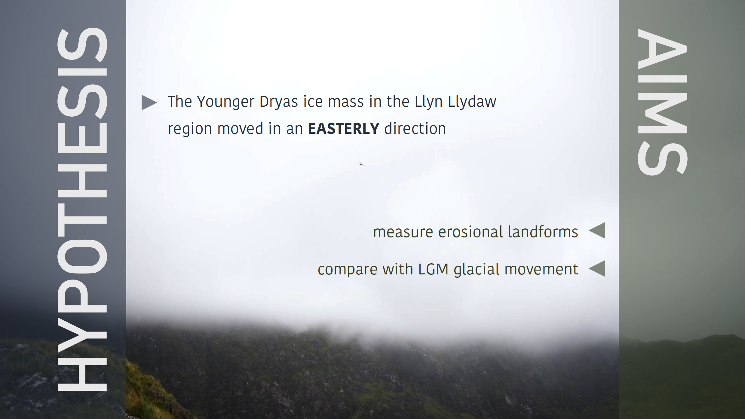
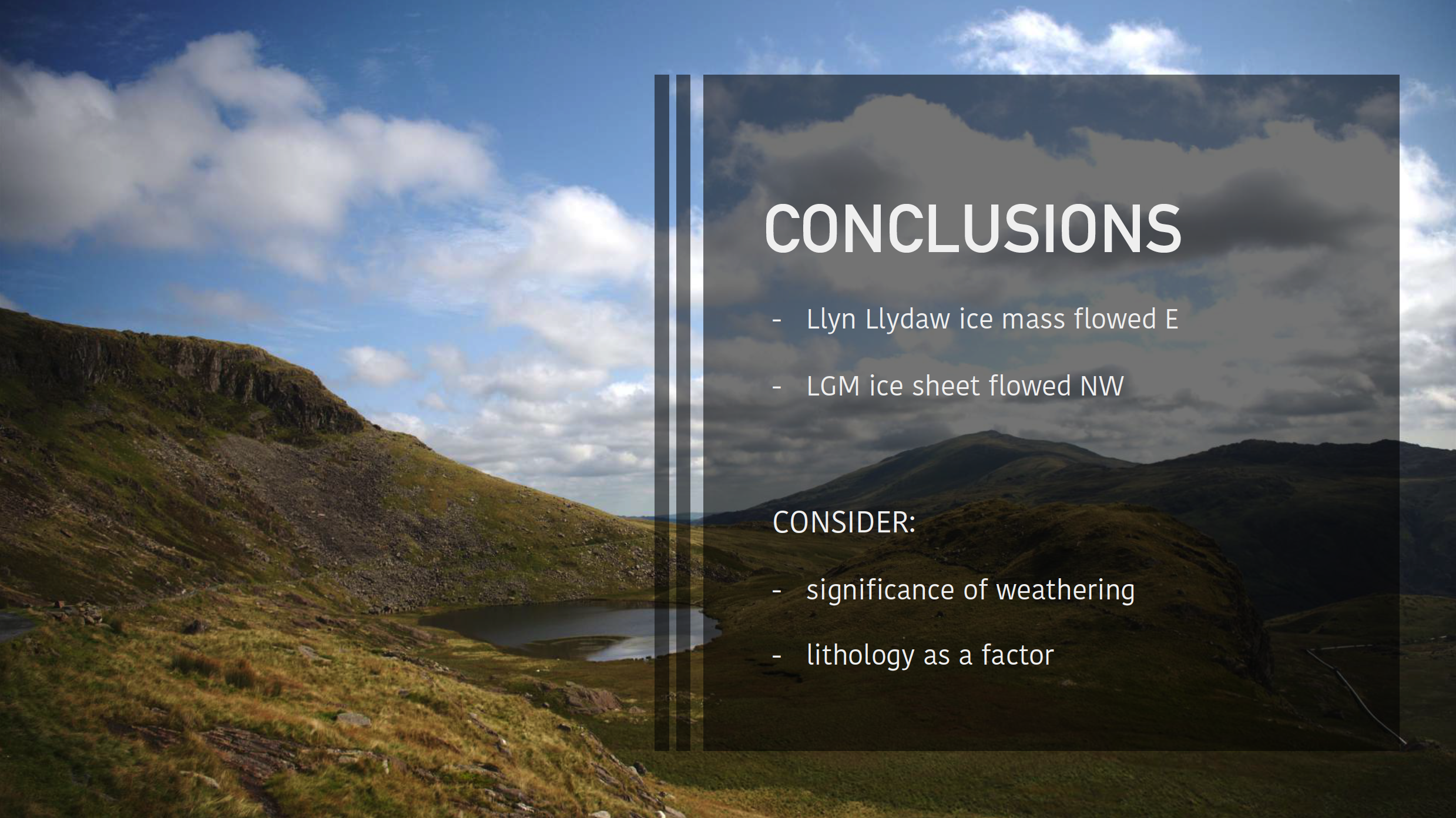
Overview: My group (Team Rocky Bangor-Boa) was assigned to determine the direction of ice-flow in the Llyn Llydaw region of Snowdonia National Park, Wales during the Younger Dryas. We spent two days in the field, identifying landforms indicative of glacial erosional processes (namely striations and roches moutonnées), recorded their GPS coordinates, and mapped them using ESRI ArcGIS software. An analysis of the landforms’ distribution and orientation revealed that we were, in fact, looking at evidence from two different ice masses from two different times: 1) a Younger Dryas mountain glacier that primarily left striations, and 2) a continental glacier – an ice sheet – during the Last Glacial Maximum that left striations and roches moutonnées.