

the hólar deposit
The Land of Fire and Ice
Straddling the mid-Atlantic ridge, Iceland has long been a quintessential study site for geoscientists interested in understanding the dynamics of fire and ice in glacio-volcanic systems. These dynamics are rarely seen on earth and for this reason, I travelled to Iceland with my university to examine the validity of two theories surrounding a mysterious volcanic landform–the Hólar Deposit.
The Hólar Deposit and Jökulhlaups
Two mounds of a black volcanic material called “pumice gravel,” the Hólar Deposit is a characteristic feature of the Sólheimasandur landscape in southern Iceland. The Deposit was formed as a continuous feature that has since been incised over time and divided into East and West Hólar by a river originating from the Sólheimajökull glacier, situated immediately north. A chemical analysis of the Hólar pumice gravel traces its origins to the nearby Katla volcano, and a study of the Deposit’s sediment composition reveals that it was deposited by a flood event.
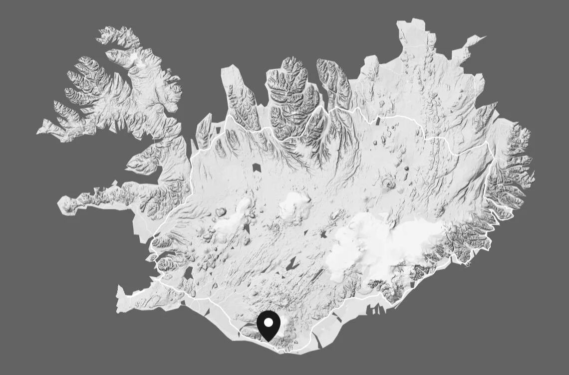

Location of the Hólar Deposit, situated near Sólheimajökull glacier and Katla volcano in Sólheimasandur, southern Iceland. The Deposit has been incised over time by the glacial river into East and West Hólar.
Partially overlain by ice, Katla is one of Iceland’s largest and most active volcanoes. A subglacial volcano, Katla often generates an accompanying flood event when geothermal heat melts overlying ice during an eruption. This kind of flood is a “jökulhlaup” (yaw-kuhl-aup), an Icelandic term meaning “glacial run” that describes any large-scale flood generated by glacial systems. Jökulhlaups can be triggered by a subglacial volcanic eruption–in the case of Katla, they are known as “Katlahlaups”–or the draining of a lake dammed by a glacier, among other processes.
Despite knowing the volcanic origins of the Hólar Deposit, uncertainty remains as to when it was formed on Sólheimasandur. This mystery led to the development of two contesting theories: one by Bjarki Friis, proposing Hólar deposition via a 10th-century Katlahlaup; and another by Andrew Dugmore, proposing Hólar deposition via a 14th-century jökulhlaup triggered by the drainage of an ice-dammed lake. My research group, affectionately named “The Hólar-Back Girls,” thus, began our investigation of the Sólheimasandur landscape to determine which theory, ultimately, prevails.
Theory One: 10th-century Eruption and Deposition
To determine the timing of the Hólar Deposit, Bjarki Friis referred to historic records of Katla activity and Katla indeed erupted in the 10th-century, likely producing a Katlahlaup. Friis’ theory was also largely founded on sediment evidence at East Hólar, and upon examining the same sediment, my group noted layered sections with rocks and boulders at the bottom and pumice gravel and loose gravel at the top. This gradated profile is indeed a classic indicator of flooding, whereby heavier material was deposited first and lighter material later as the flood lost momentum. Friis’ theory, however, is inaccurate and insufficient in constraining time, especially in a landscape with an active history of volcanic activity and jökulhlaups. Sediment is, furthermore, just one piece of evidence in the larger examination of a landscape’s history. Finding Friis’ theory insufficient, my group then considered Andrew Dugmore’s theory, which examined the greater context of the Hólar Deposit.

Depiction of Friis’ theory, which suggests the Hólar Deposit was produced and deposited in the 10th-century by a Katla eruption and ensuing Katlahlaup.
Theory Two: 10th-century Eruption and 14th-century Deposition
Upon broadening the scope of the investigation and observing glacial features in the surrounding landscape, Andrew Dugmore proposed that Hólar material was produced in the same 10th-century Katla eruption Friis identified, but instead of being transported to Sólheimasandur via an ensuing Katlahlaup, the Hólar material was first deposited into a lake dammed by Sólheimajökull glacier and subsequently transported when the lake drained in the 14th-century.
When reconstructing glaciated landscapes, a crucial landform to consider is the glacier. The size and extent of a glacier changes over time and as it grows and shrinks, it leaves behind erosional and depositional features–the former typically evidence of a glacier advancing over a landscape and the latter of glacial retreat or melting. A key depositional feature is the “moraine,” mounds of glacially entrained material–gravel, rocks, and sediment–that are left on a landscape after the glacier has melted, essentially marking a glacier’s maximum boundaries at a given time. Moraines, therefore, serve as valuable evidence for reconstructing a glacier’s history.
Existing glacial reconstructions show Sólheimajökull has undergone significant retreat since the 10th-century. In the landscape surrounding the Hólar Deposit, there is a cluster of moraines left by Sólheimajökull at the southern end of West Hólar, in addition to an arcuate series of moraines that begin at north of East Hólar and continue east. Upon mapping these moraines and comparing them with existing records, we determined that the cluster north of East Hólar marks Sólheimajökull’s maximum extent in the 14th-century. Constraining this date means the cluster south of West Hólar not only marks glacial extent before the 14th-century, but it also disproves Friis’ theory because Sólheimajökull would have occupied the area where the Hólar Deposit is found, making deposition implausible.
In addition to sampling moraines, we also examined aerial photos of study area and identified a ridge that separates Sólheimasandur from a terraced landscape in the west. Dugmore speculates that jökulhlaups would have flown through this landscape when Sólheimajökull was larger in the 10th-century. A closer examination of this adjacent landscape indeed reveals evidence of jökulhlaup activity and also significant quantities of Hólar-equivalent pumice gravel, presumably from the same 10th-century Katla eruption. So, if moraine evidence suggests the Hólar Deposit was deposited onto Sólheimasandur around the 14th-century, then where was the Hólar material between its time of production in the 10th-century and its time of deposition in the 14th-century.

Dugmore suggests Hólar material was first deposited into an ice-dammed lake, following a 10th-century Katla eruption, while a different pumice gravel deposit was formed to the west of Sólheimasandur.
Based on Sólheimajökull’s 10th-century extent, Dugmore speculates the glacier was substantial to dam a glacial lake along its northern boundary and that this lake would have been where Hólar material was first deposited. From aerial photos, there is a visible indentation in the landscape and a hike to the site confirms the presence of a large box canyon that could reasonably be a relic ice-dammed lake. Closer observation also reveals Hólar-equivalent pumice gravel on a ledge a quarter of the way down, adding confidence to Dugmore’s proposition that Hólar material was first deposited here. As for lake drainage in the 14th-century, it is likely Sólheimajökull had retreated and thinned that it could no longer dam the lake. The contents of the lake, including Hólar material, would have then flowed over Sólheimajökull and into the greater Sólheimasandur landscape in a small-scale jökulhlaup to, thus, form the Hólar Deposit.

Dugmore proposes the ice-dammed lake drained in the 14th-century when Sólheimajökull retreated from its 10th-century extent, thus transporting the Hólar Deposit onto Sólheimasandur.
For Dugmore’s theory to be plausible, however, the box canyon needs to be large enough to have held a lake and the entire Hólar Deposit. My group estimated the capacity of the box canyon with a topographic map and conducted a thorough perimeter walk of East and West Hólar to determine their volumes. Because the Deposit was originally a single unit that had been later incised, we estimated the volume of the missing center section by averaging height and length measurements from East and West Hólar. Upon calculation, my group confirmed that the box canyon could indeed have contained a lake with the entire Hólar Deposit.
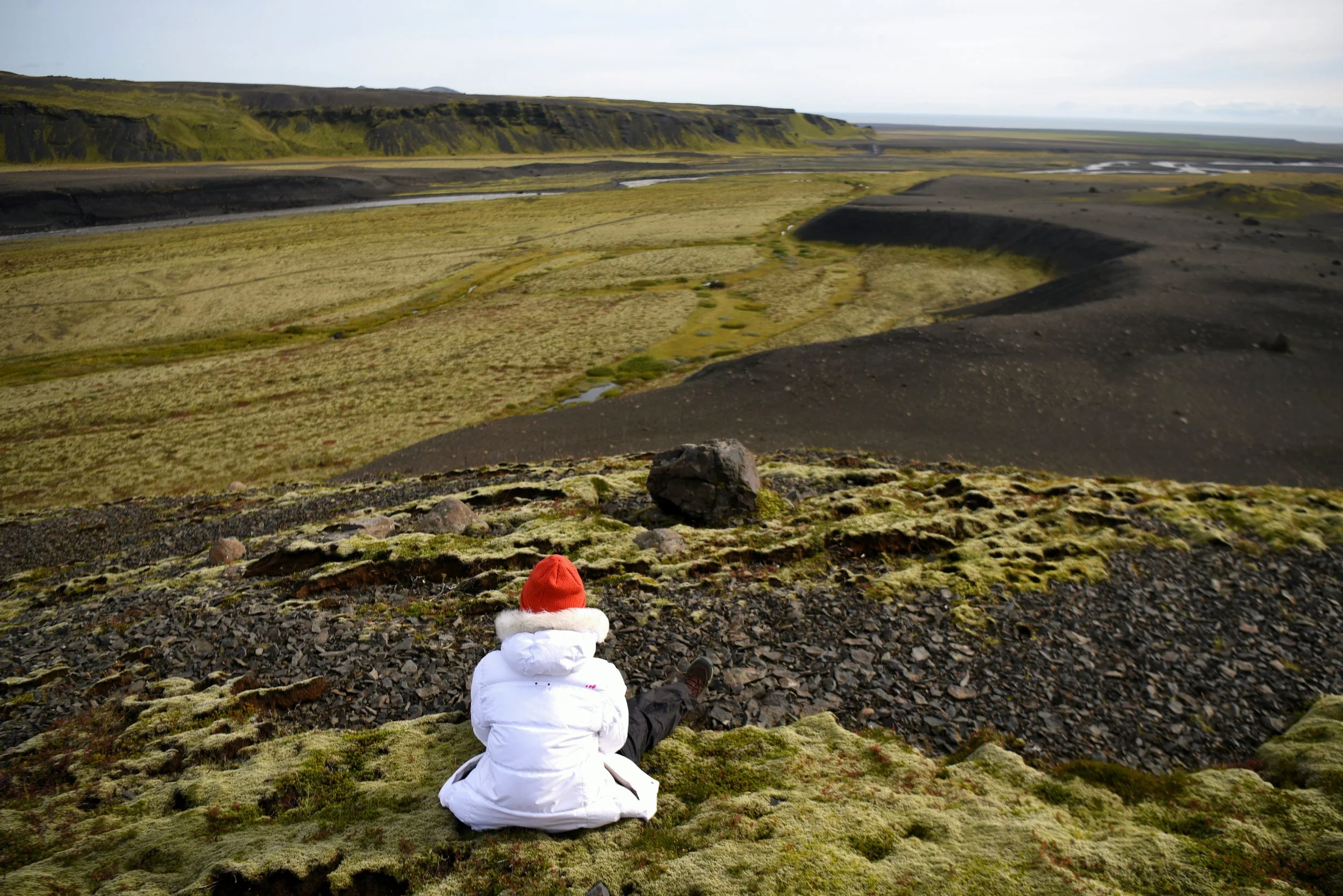
Looking south over West Hólar.
A Mystery Solved?
Determining how the Hólar Deposit arrived on the Sólheimasandur landscape was a rigorous and fascinating project, as well as a reminder that scientific research should demonstrate truth and authority through comprehensive consideration of evidence. My peers and I evaluated two contesting theories on the Hólar deposition and upon careful analysis of sediment evidence in its greater geomorphological context, we found more credit in Andrew Dugmore’s theory of a 14th-century deposition. Bjarki Friis’ research presented thorough examination of sediment that supported his theory of a 10th-century Katlhlaup deposition, though the evidence was insufficient in constraining a date and was, furthermore, inaccurately considered in isolation of other landscape features. In testing Dugmore’s theory, we collected a more robust set of evidence reflective of the entire landscape and built a more compelling story. There is still research to be done, however. The 10th-century pumice gravel deposit formed west of Sólheimasandur, for instance, should have a corresponding deposit in the landscape east of Sólheimasandur. No fieldwork has been conducted in that area yet to determine evidence of pumice gravel, which, if found, would further consolidate Dugmore’s theory and enhance existing landscape reconstructions. While Dugmore’s theory is compelling, it is still research in progress. Perhaps the most we can conclude is that it is more valid than Friis’, and the rigor with which science is performed is a testament and standard that research should be conducted as a comprehensive evaluation of individual samples in their greater context.